The Map is not the Territory
April 2, 2023 – Day 46
We spent a lot of time in the morning setting up plans and accommodations for the next couple stops. This proved to be a problem since the upcoming weekend is Easter weekend. We’re guessing schools are on vacation because so many campsites are booked solid. This is a real shame since we love going to Lums Pond State Park in Bear DE. We’ve been there twice before and it is a good place to stop, visit my brother, and make a run for home. We had also wanted to go to the Great Dismal Swamp for wildlife viewing. We found that all the campsites there were booked. Then we tried the Alligator River National Wildlife Refuge and also found those booked.
We eventually found a place at Kiptopeke State Park way down at the bottom of DelMarVa peninsula near the Eastern Shore of Virginia National Wildlife Refuge. We should be able to see some migrating birds there, it is in the flyway to Cape May which is a know birding hotspot.
Curiously, many camp sites don’t have web reservations you have to call them! After we booked Kiptopeke one of the ones near the Alligator River called back and had a spot!
We then booked another campground, French Creek State Park near where my brother lives so we could still have a visit on the way home. Susan found us a Harvest Host and now we have places to stay for the next 10 days!
This is always the tradeoff when traveling. Do you want the freedom to go where and when you want or where the weather drives you to? Or, do you want the security of knowing where you’ll be? We’ve done both and it is hard to say what is better.
After some lunch we headed out to explore. We wanted to go to the Cataloochee Valley, a section in the Great Smokies that is well, duh, a valley, surrounded by 6,000 foot mountains. It was actively farmed until around 1910 or so and there are still old houses there and an active Elk population. The Elk are what we wanted to see.
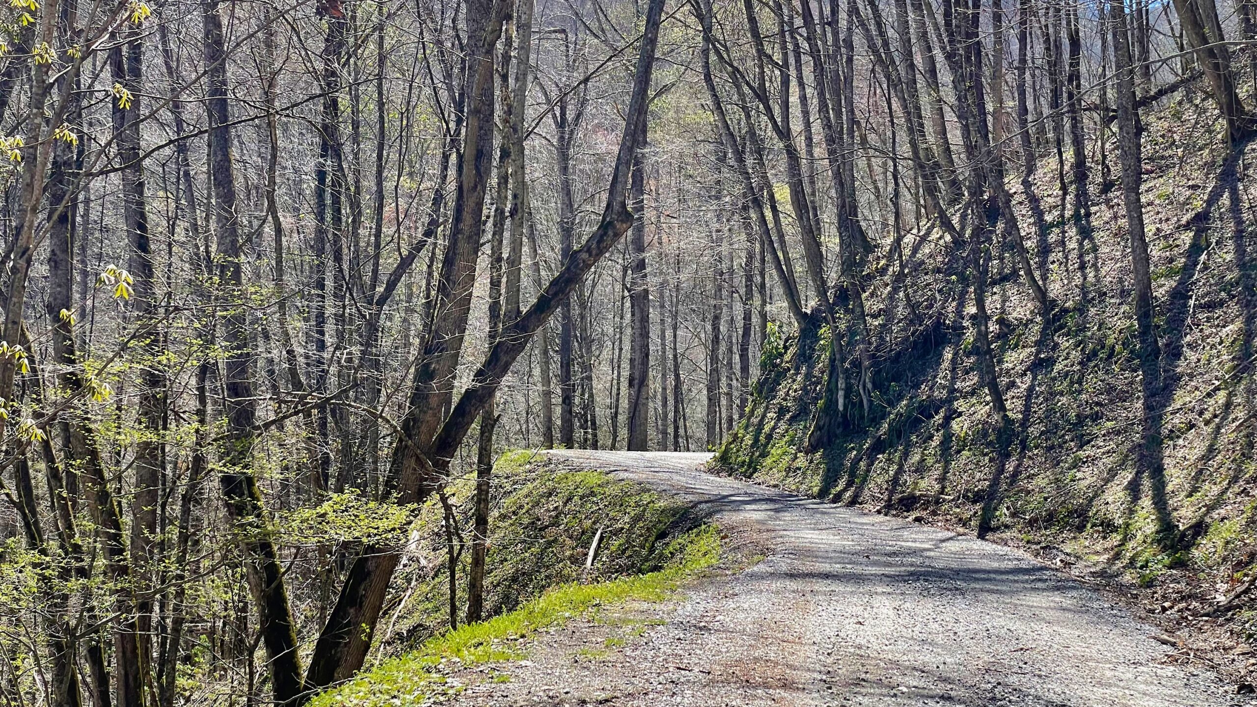
The road to the valley is narrow, steep and lots of hairpin turns. You need to be prepared to back up to a wide spot and let traffic by. Neither of us could figure out the protocol for that. Probably the one closest to the cliff edge gets the go and the other hugs the not-cliff side to enable passage of the former.
But we had 2 ways to get there, the easy way or the hard way, so of course we choose the hard way!
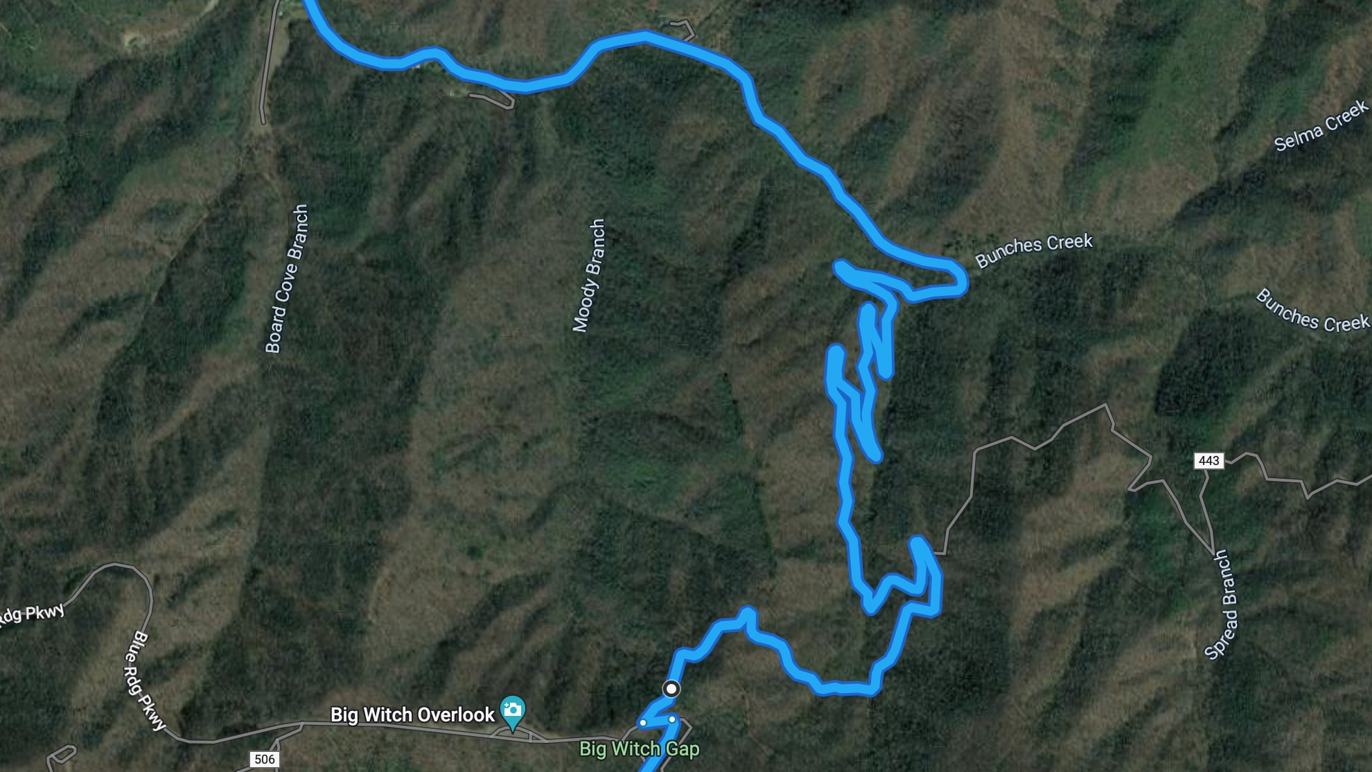
This road delivered on so many levels. First, it was pretty terrifying. We checked our Apple Watches later and we both had greatly elevated heart rates. But it was also gorgeous.
Yes, the vertigo was really strong on this road. The driver had it easier since they dared not look away from the road.
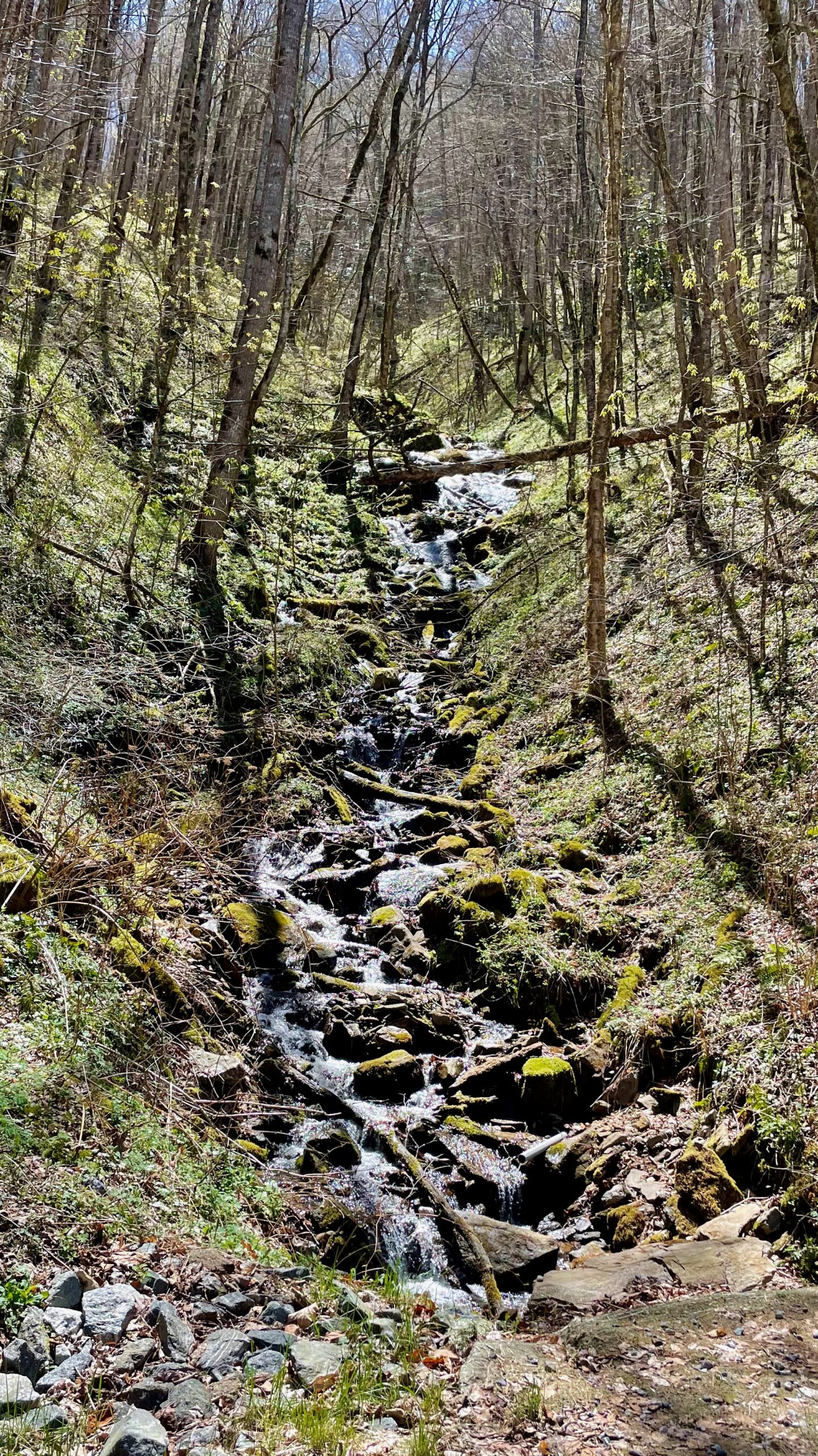
There were waterfalls around every bend. There would be a culvert under the road and the water just kept on going downwards.
Eventually we came to a locked gate.
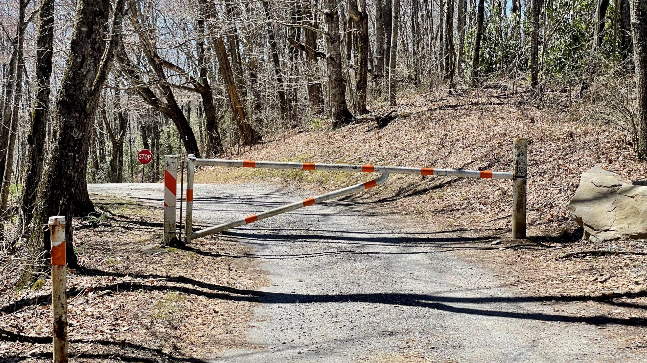
We were right on the boundary of the Cherokee Nation and the United States, so I figured that the gate was closed for Tribal reasons. That stop sign right behind is the Blue Ridge Parkway, the road we were on yesterday. And it was the road we wanted to be on.
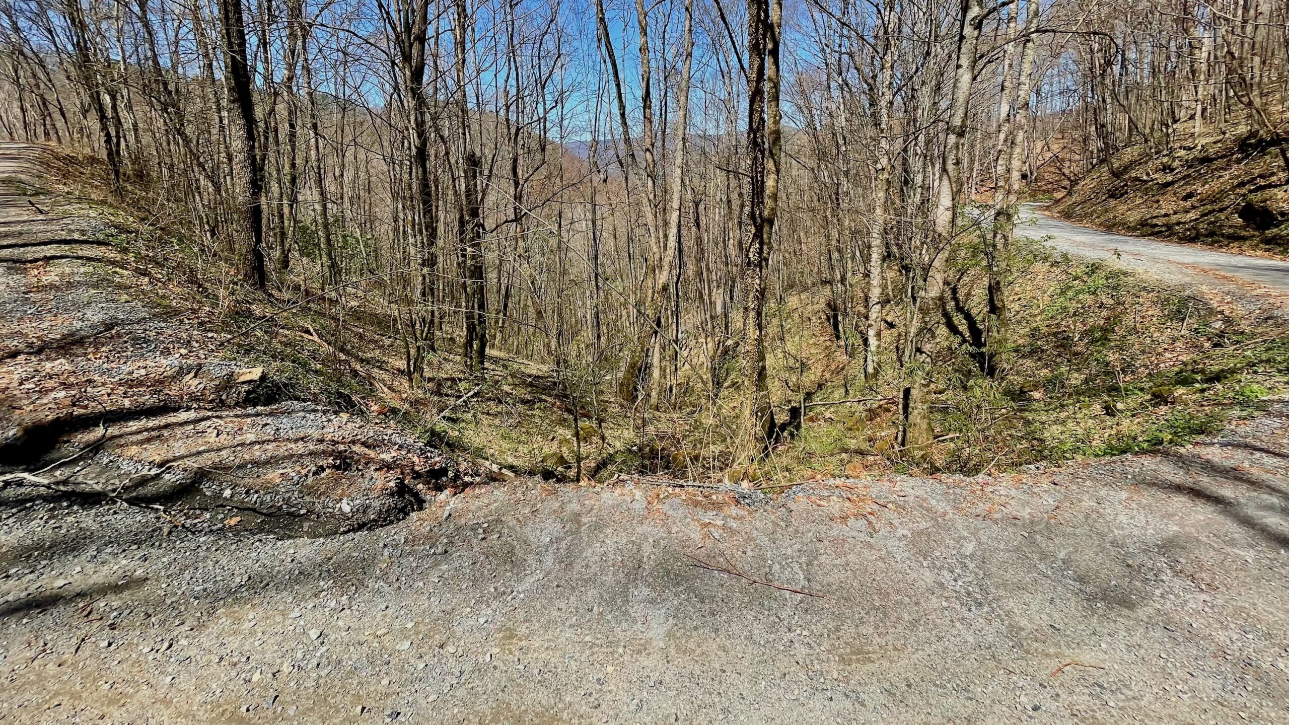
But exploring by map is not the same as exploring by car. We didn’t want to turn around and go down that road again. We had two roads ahead of us. One went under the Parkway.
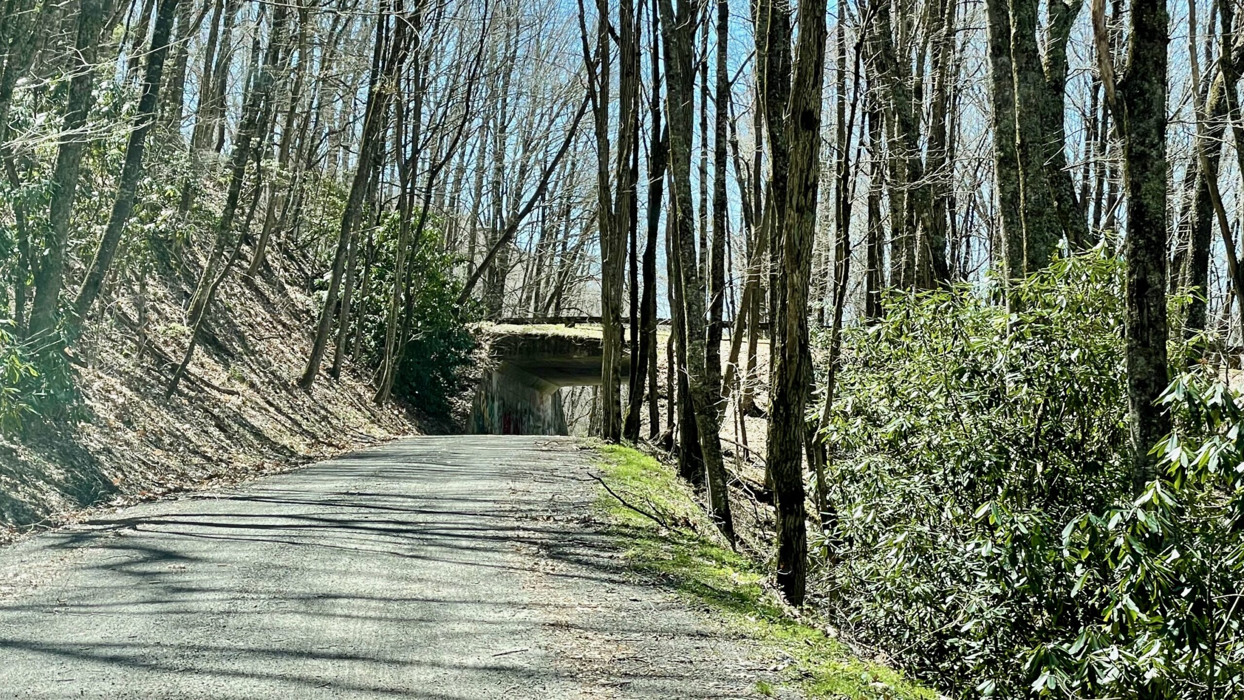
The other was parallel to this one but climbed. I figured it must also be an entrance to the Parkway so we took it. It wasn’t. Fortunately there was a really wide spot where would could turn around. We stopped there and looked at our maps. Going ahead was miles of this road which was called the Mile High Road. Worse, it wasn’t clear if was a dead end. The under the bridge road looked like it went to a residential neighborhood fairly soon, so we turned around and went under the bridge and were back on pavement soon.
It was over an hours drive to the Cataloochee Vallery, we drove through tourist trap after tourist trap, Maggie Valley and some other small towns. Note: if you need a First Nations blanket, dream catcher, bear meat, CDB or even a life sized Bigfoot statue, we can get you a deal.
We were just a few hundred feet from the Cataloochee entrance and were pretty excited. There should be birds and elk there. So far the road to this point wasn’t nearly as bad as the former, Bunches Creek Road. Then we came to another gate!
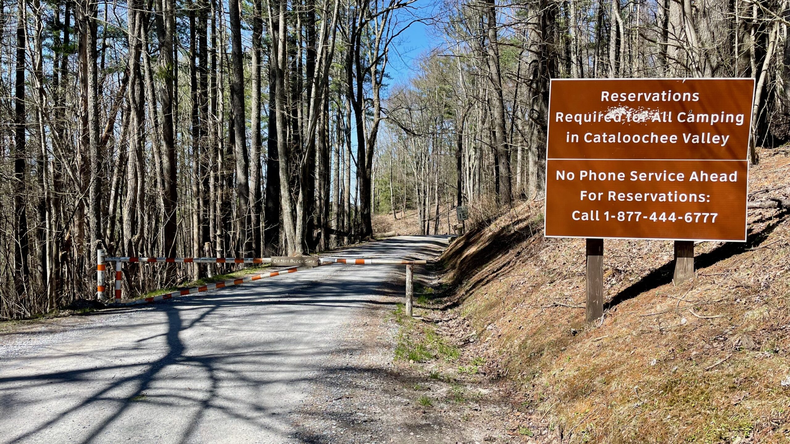
We were pretty bummed. We had checked out the NPS twitter feed that morning, no roads were reported closed. We turned around and pondered what to do and a car came out!
Then another and I jumped out to ask them what’s up. There was a Ranger who was chasing everybody out, they didn’t know why, and yes, they had seen elk! We thought we sit for a bit and wait and ask the Ranger if it would be open tomorrow, so we did. About 10 minutes later another car came out. I asked them if the Ranger was close behind, they didn’t think so. We briefly considered heading in and if confronted by a Ranger plead…something. In the end we decided to remain on the right side of the law (for now, more about that later).
We turned to go home and met up some some adventurous young at heart folks. I rolled down my window to tell them it was closed ahead. The driver said to me, “We’re terrified!” I said they should be, the passenger then said, “She needs a whisky.” We all laughed.
We headed back to campground so we could call the park, but decided to go to the nearby Oconaluftee Visitor Center to ask them about the closing, figuring that I’d get a person, not a phone that rang forever.
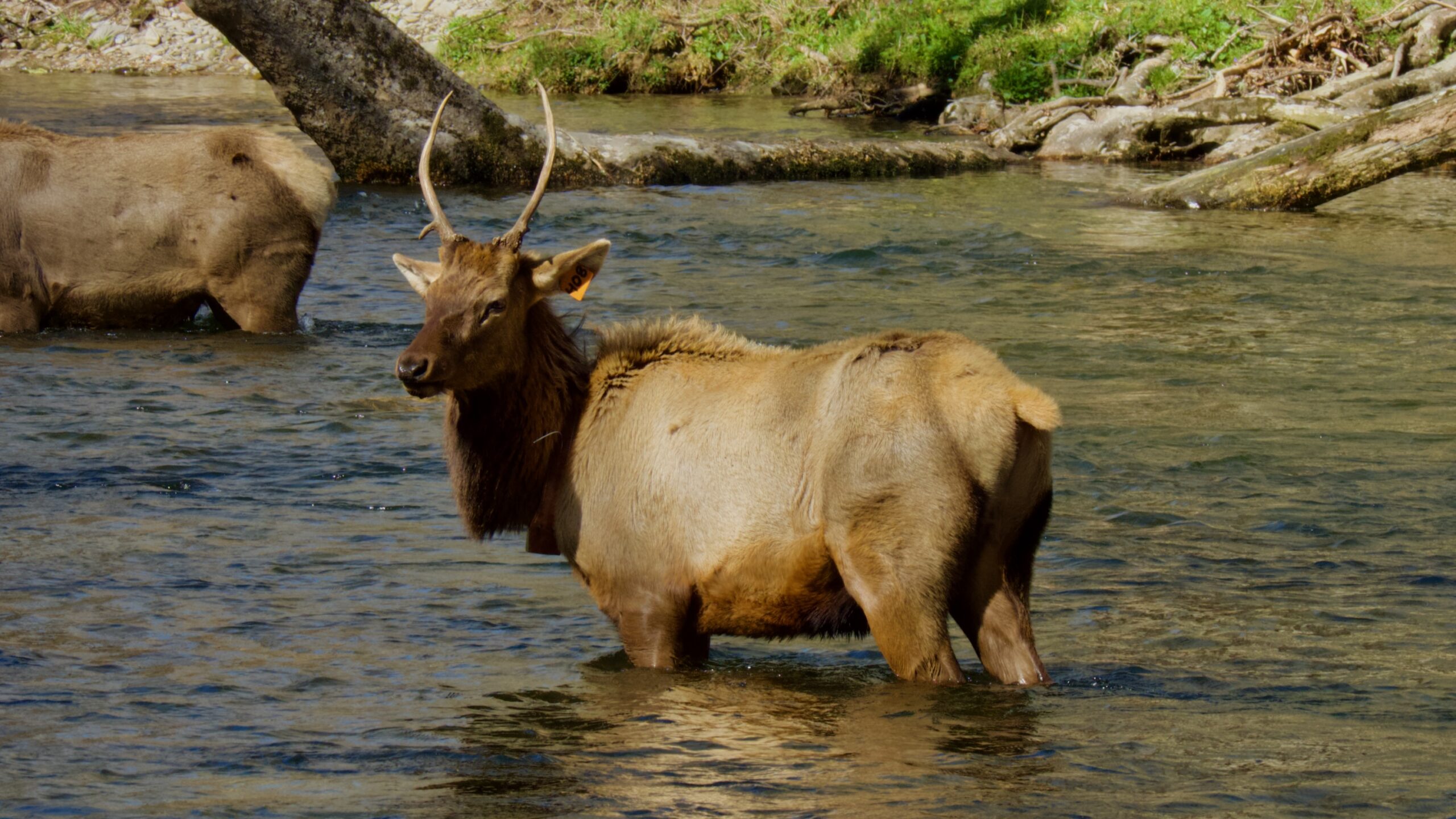
And on the way we found a ton of parked cars right before the Visitor Center, I’m thinking, oh no, it is so crowded they’re parking on the roadway. Then Susan points and yells, “Elk!” I grabbed the first spot I could and we followed the throng of people down to the creek to see the elk.
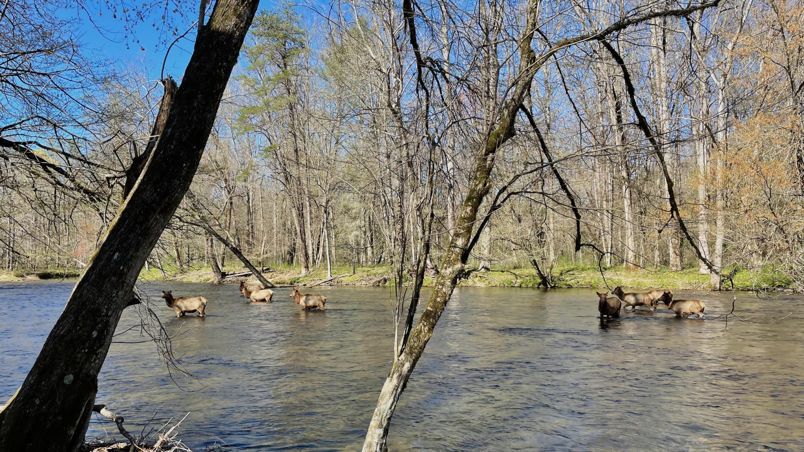
I counted 14 of them, one buck and at least one calf. There was a private tour guide there and he was giving us all sorts of facts, including the fact that the biggest source of mortality was automobile accidents!

And no, I don’t know what those things are. The private tour guide had said there around about 70 elk in the area. I’m guessing that those are tracking collars.
Soon he moved his group on, “Who wants to see a haunted church?” We continued to watch them. More people showed up and Susan noticed the Park Ranger coming down. “Ranger!” she said and we all scattered back to our cars. I had figured we were parking illegally but later, at the Visitor Center, I found a pamphlet that said it was illegal to be within 50 yards or them. I had wondered about that. I’de never be that close to a moose but I felt fine here. Susan says her head was on a swivel, looking out for me, aww… shucks…
(Susan here: he gets pretty focused if he’s taking pictures and the herd was separated into 3 groups. If one gets spooked and run they’ll all run. Best to be aware. And I was also aware that we were far too close, probably only 25 yards. And that being that close could get us fines and/or jail. In this case it’s up to 6 months and/or $5000! I knew from our time living in the National Seashore that most Rangers would rather educate. I figured the worst that would happen is we’d be scolded and sent on our way.)
At the Visitor Center we found out that the Valley was closed because of a tree down on a power line. Now we figure a deserted valley has got to really be low on the priority list so we’re not going to attempt that again, plus, we already saw our elk!
And on the way home, we found more!

April 3, 2023 – Day 47
Not much for today. It’s raining, we’re doing trailer things like playing board games and Susan will continue to teach me to knit. Plus we’ll have time for pork stew for dinner.