Carved in Stone
May 19, 2024 — Day 65
KOA/Dinosaurland Vernal UT — Steinaker State Park, Vernal, UT
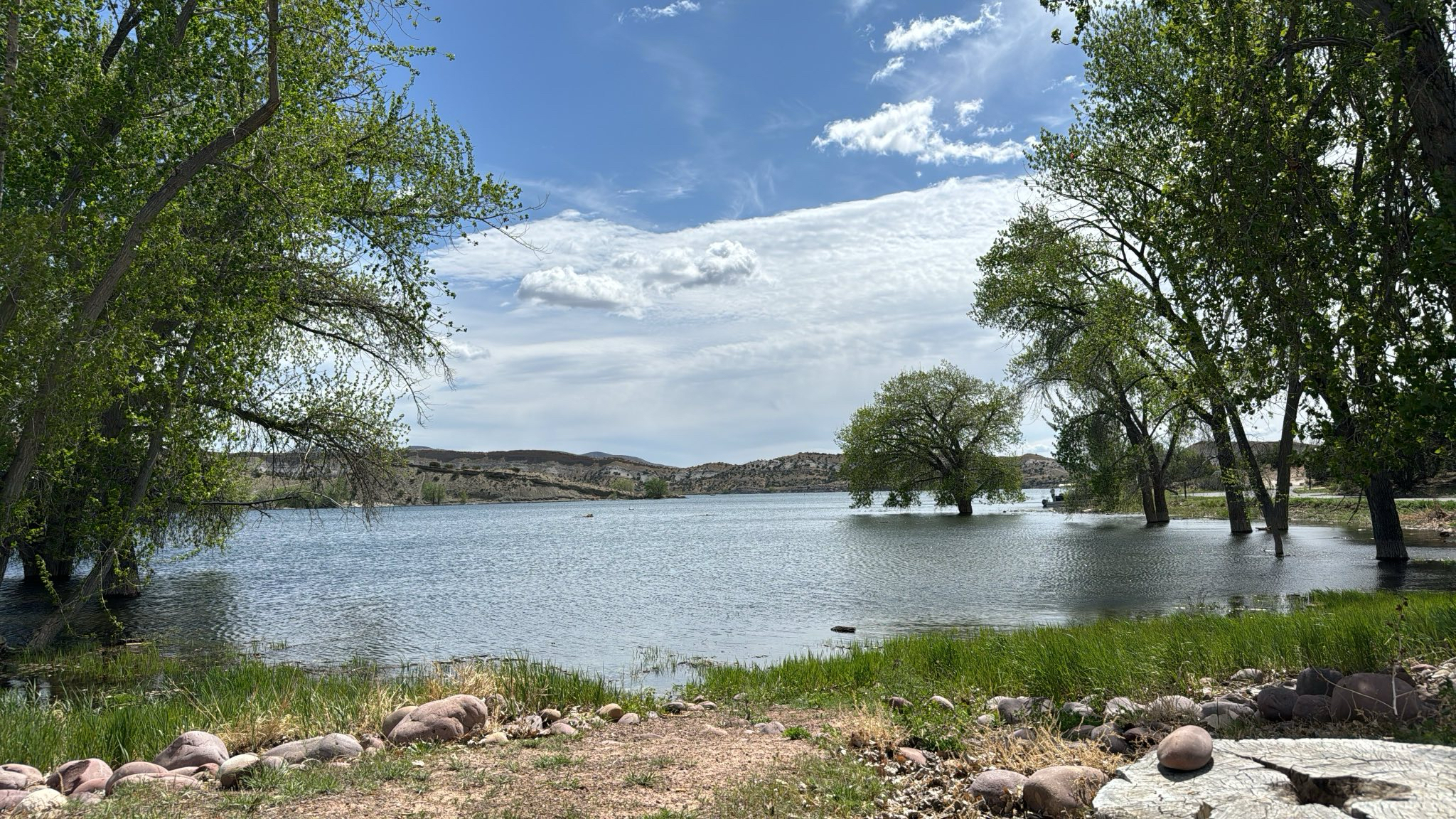
Today was moving day. We left the KOA in town and headed out to Steinaker State Park. It was an uneventful 9 miles IF you ignore the rut that the RV drove over as Susan left the KOA. They use shallow channels on each side of road. It makes for bumpy coming and going. This one sent water in the cups for the herbs splashing about. And the Cherry tomatoes took a header when the door opened. They scattered all over the floor like little red marbles. This state park is so much nicer than the KOA and it’s a waterfront site. Even better.
After we settled in we still had most of the afternoon to adventure. “Let’s see if we can drive to the Moonshine Arch.” said Paul. He talked with the rangers and found a booklet which one could interpret that a Jeep was a “Type II Off Road” vehicle and was therefore allowed on the OHV trails. Susan read further and found the spot about registration and Paul hastily said, “Stop reading, we want plausible deniability here, right?”
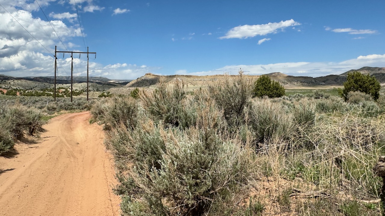
Google satellite images show that it is possible to get there. One road is clearly marked “This is not the road to Moonshine Arch” so we tried the OHV road next to it. The entrance was wicked muddy. We had found out from another camper that it had poured the previous day. Mud is hard to read. Is it an inch of mud or a foot? You just don’t know until you’re in it.
Well, it was muddy but Ruby pulled us through. (susan here: sideways. Like a crab walks.)
We quickly came to a gate and thought we could find another way. Sadly, the other way was both leading us away from the arch as well into some tricky terrain. If we wanted tricky terrain we would just drive the road we turned away from the previous day.
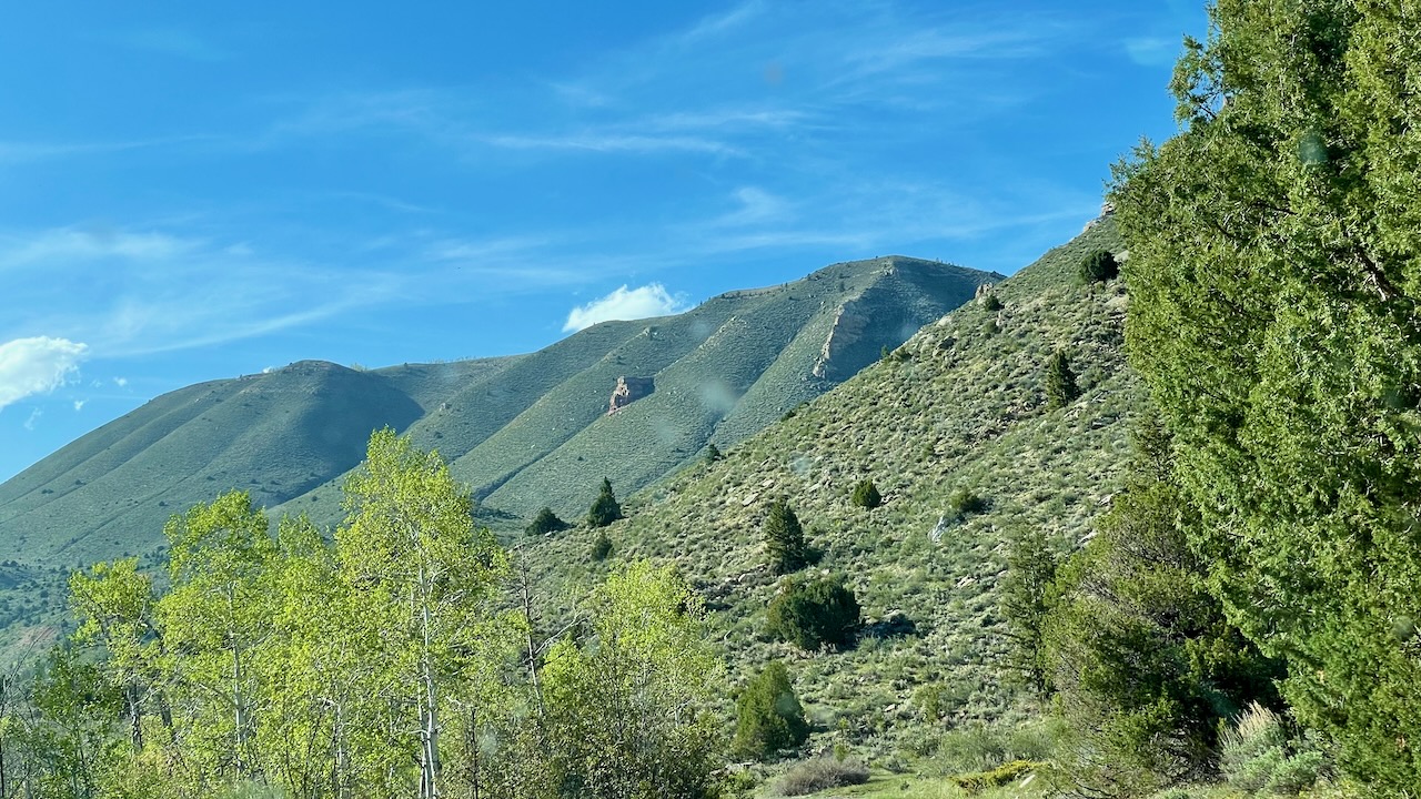
Still, the views were grand.
On the way out we had to go through that muddy section again, Susan hates when the Jeep gets tilted. So she got out. That meant she shot some video. Here’s a screen capture from that.

So now we are twice thwarted from the Arch. What to do for the day’s adventure? Remember that “child ranger” that told us about an easy hike? Easier than the Moonshine Arch? Sold! We headed out to see the McConkie Ranch Petroglyphs.
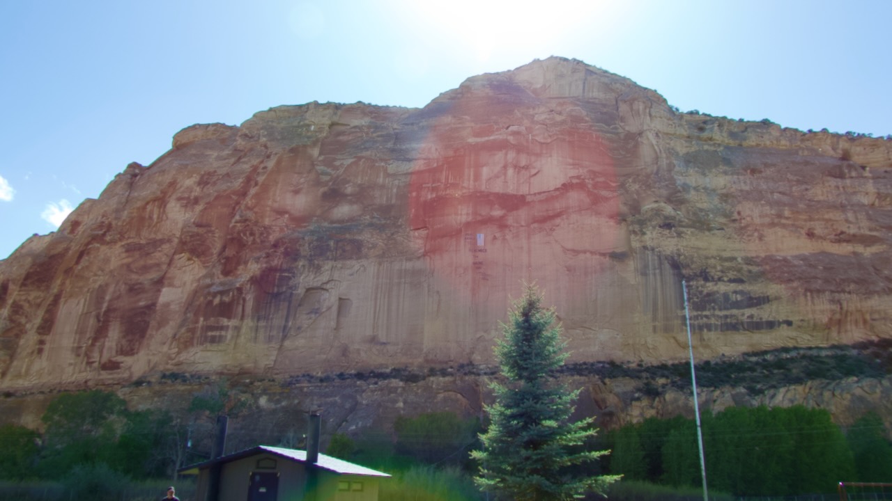
On the way we stopped at the Remember the Maine Park. This park has a picnic pavilion, horseshoes, etc.. and it all faces a tall sheer wall where there’s a a giant American flag with the motto “Remember the Maine,” honoring the servicemen who lost their lives when it sunk in Havana Harbor in 1898.
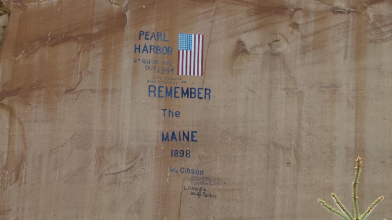
The Maine, and her sister ship, the Texas, sound really familiar. We’ve seen some history of one of these ships before. The curious take aways from these ships were that both were obsolete before they were launched and the “Remember the Maine” battle cry was an early example of yellow journalism. You see, the Maine might not have been sunk but just exploded due to mismanagement.
But, onwards to the McConkie Ranch!
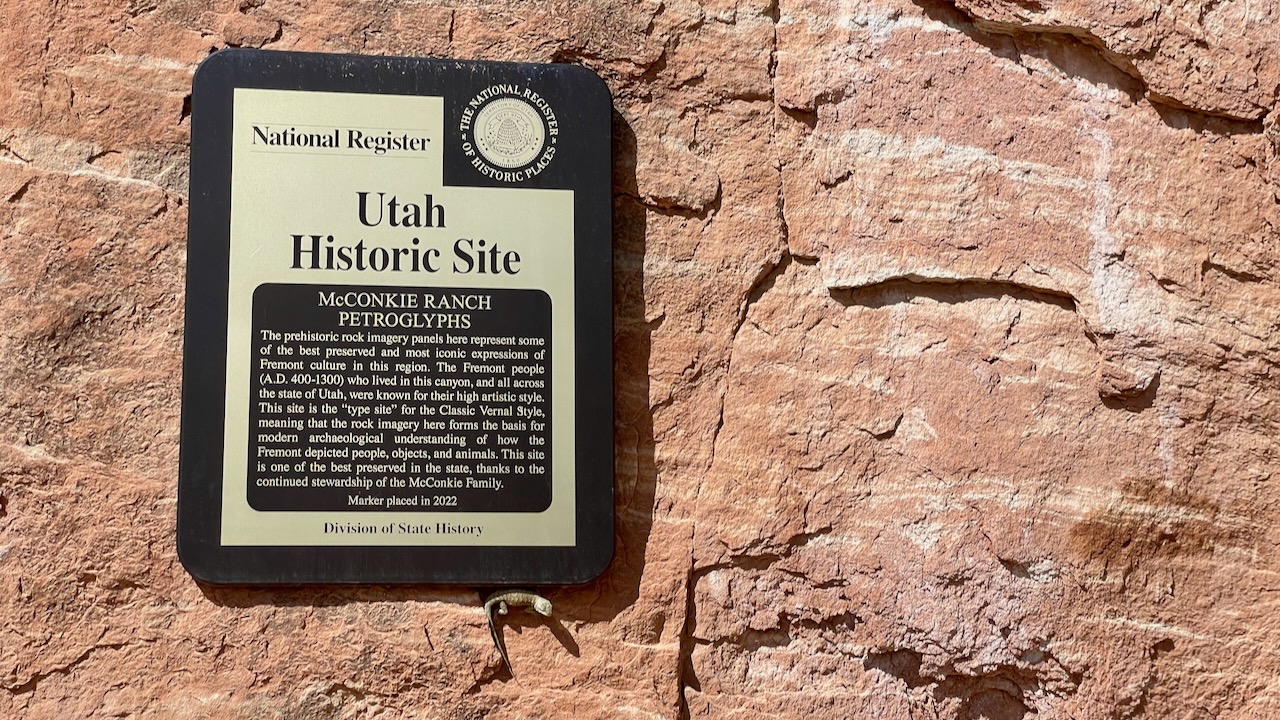
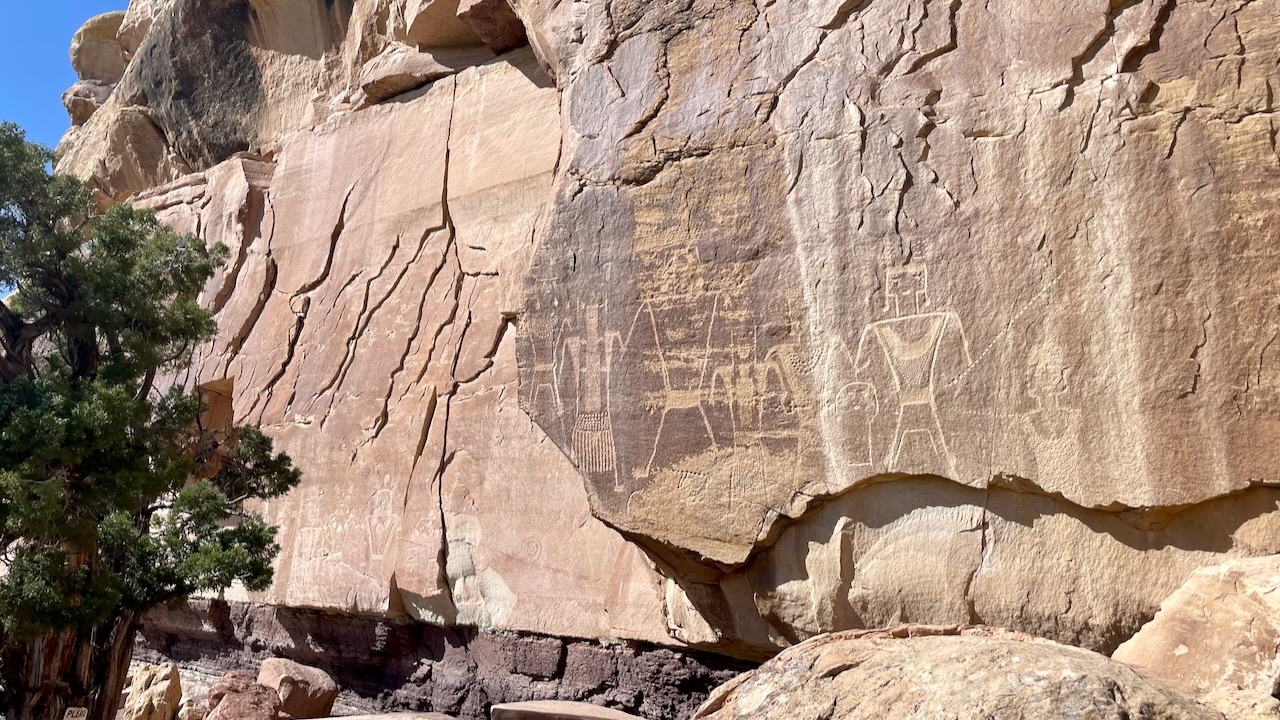
THESE BEAUTIFULLY PRESERVED PETROGLYPHS ARE just north of Vernal, at McConkie Ranch in Dry Fork Canyon. These panels cover 200 feet along a cliff face in the Navajo formation. It’s believed the petroglyphs were crafted somewhere between 1-1200 CE. They are excellent examples of Fremont Native American culture.
https://www.atlasobscura.com/places/mcconkie-ranch-petroglyphs
On the drive in Susan said “Stop the car!” and Paul obliged. What did she see? A lone Sandhill Crane in the meadow! It was mostly brown so that meant it was probably a juvenile.
We met a couple from NY in the parking lot and asked about the hike. “Nope, steep with switchbacks.” Yikes, “Is it worth it?” “Yes, they said.” OK. So we headed out.
Note the official lizard greeter at the bottom of the sign! Little lizards are everywhere in the southwest desert.
The New Yorkers were right, this was a climb!
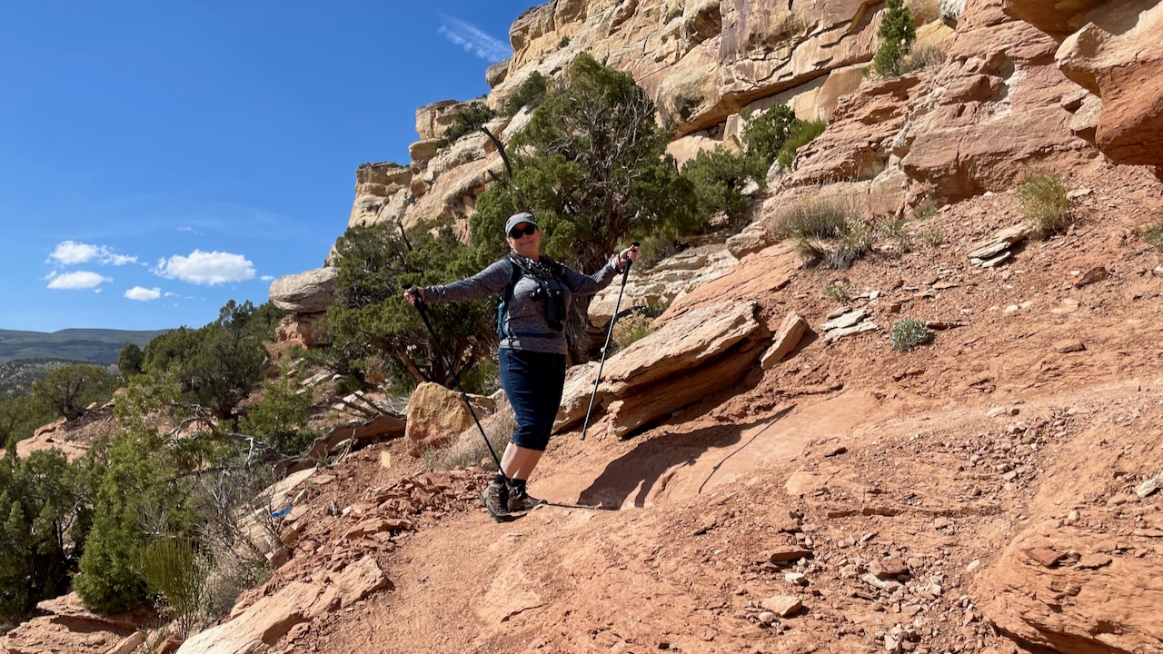
We’re not even halfway up in this photo.
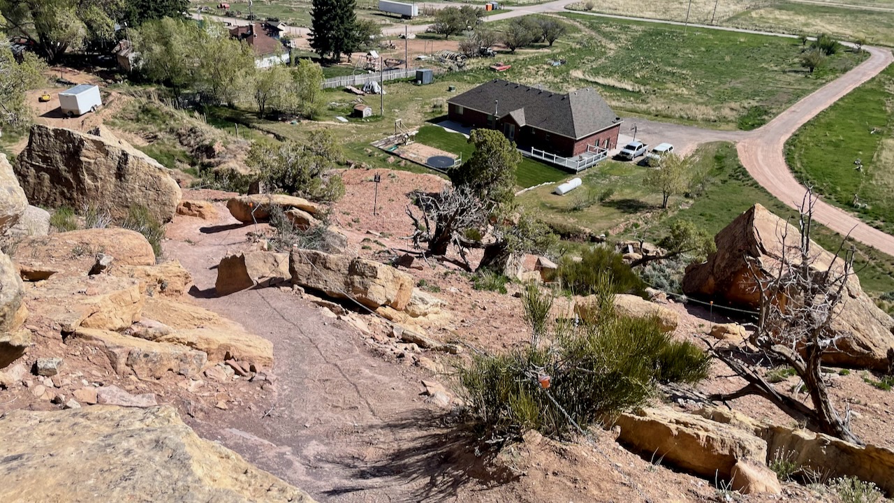
We eventually made it to the top to the first gallery of petroglyphs, they did not disappoint. It was very windy that day and it felt even windier up on the trail. Gusts in the 35 mph range sent sand flying and us holding ground until it passed. There were no railings to hold on so you didn’t want to lose your footing on this steep trail with lots of loose sand and pebbles.

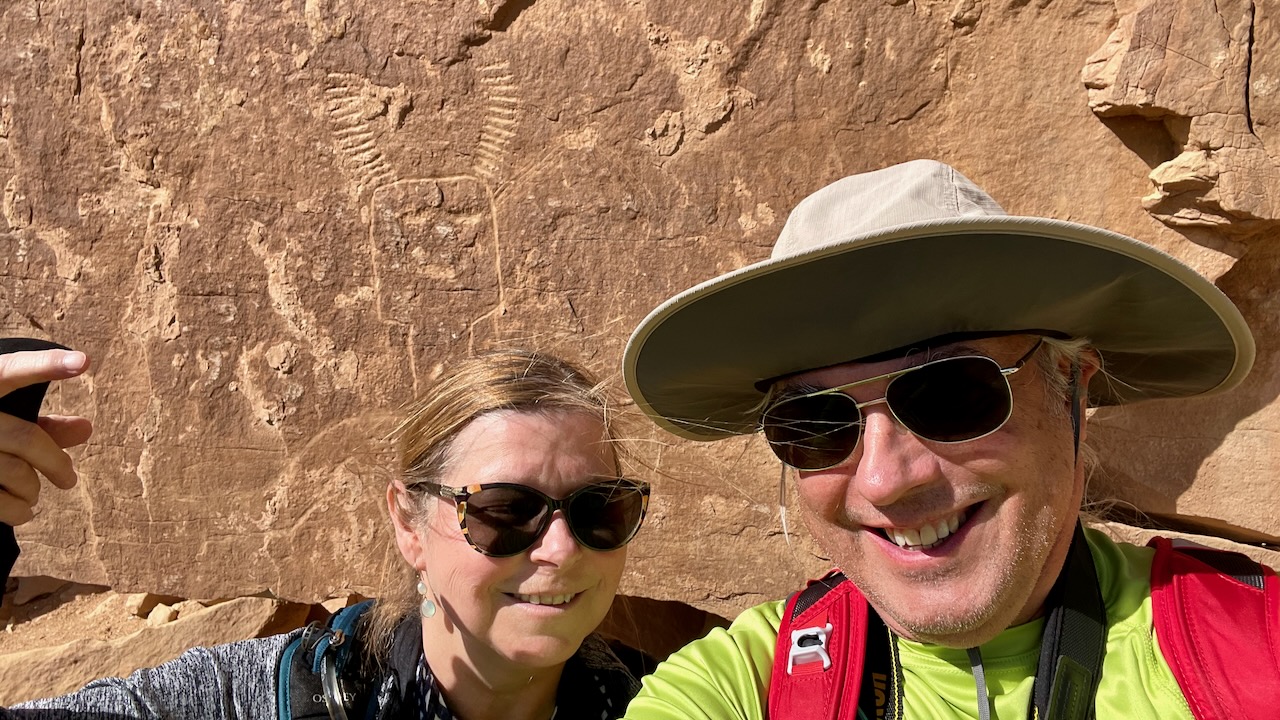
The altitude and sun was getting the best of both of us. We had to stop frequently, especially if we found shade. The good news was that once we reached them, the terrain was mostly level. There was a nice spot to rest. The trail clearly headed farther out but the glyphs had stopped. Paul checked out down the trail to see if there were more, and there were just around a bend.
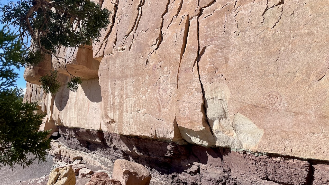
They stopped again after this. We were too beat to continue. What was that child ranger thinking when we asked for an easy hike?
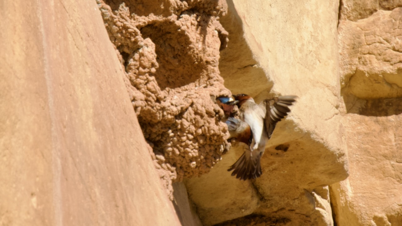
On the way down we realized there was a colony of Cliff Swallows tending to their young. They were group feeding, perhaps 50-100 of them. In unison they would swoop in, feed the young, and swoop out again. We could hear wings flapping as the group dove off their their mud nests and passed about 10′ away from us. It was great!
Paul got this great shot of one parent feeding their young.
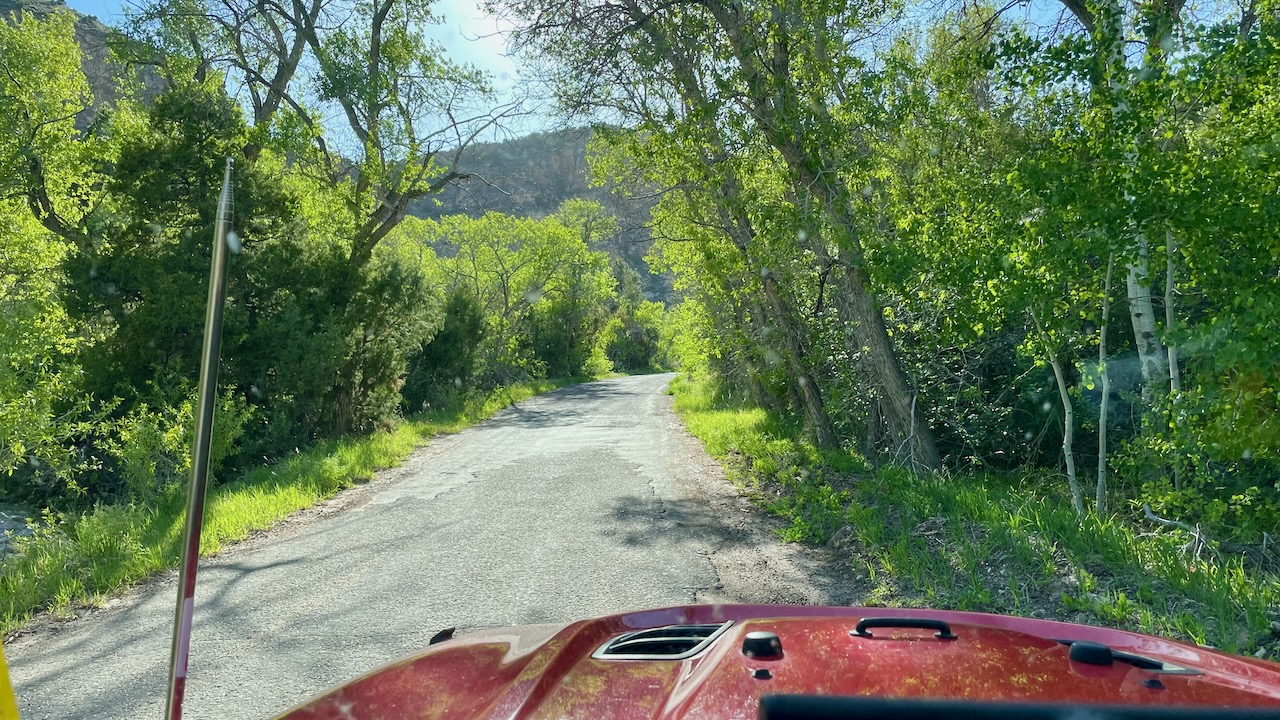
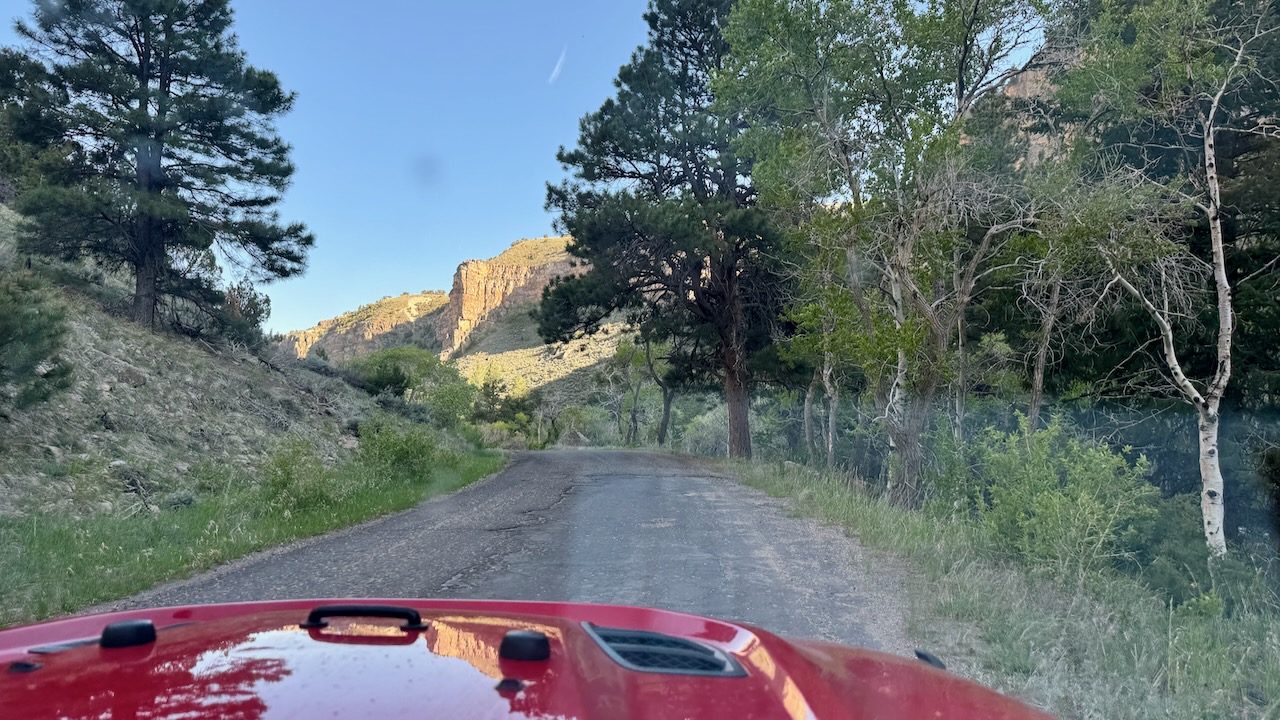
The tour pamphlet suggested we keep on driving a bit through some scenic BLM land. We were rewarded with lush green trees and cool forest temps.


Daily: 9
Total: 5,311
Driving Miles/Day: 231
Overall Miles/Day: 82
Life Birds: 1 (Woodhouse’s Scrub Jay)