“Except For the Terrifying Parts, I’m Having Fun.”
May 20, 2024 — Day 66
Steinaker State Park, Vernal, UT
We had an ambitious plan to do all of Dinosaur National Monument in one day. But some of the things we wanted to see are a 2.5 hour drive each way. We vowed to wake up “super early” (about 6:30AM) and maybe get breakfast at Denny’s in town. Then start driving. We crawled out of bed a little after 8am. Already behind schedule it was then we realized it should be a 2 day trip to Dinosaur. That’s ok, we had 2 days. What else were we going to do? Attempt another visit to Moonshine Arch? (Actually, that was the plan if we were able to do DNM in one day.)
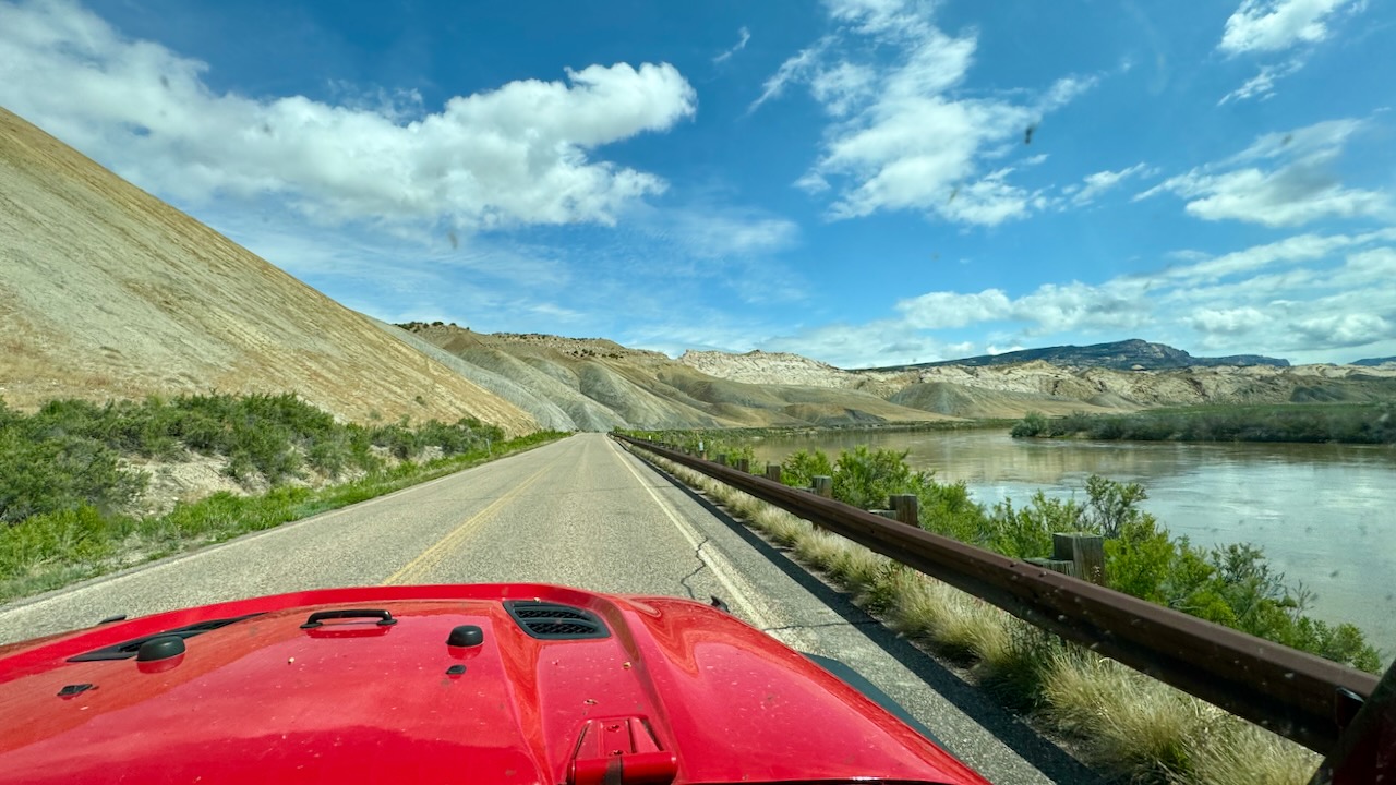
First we needed gas, no big deal, right? But we wanted to take the scenic route but we needed to go downtown for gas and some air for our leaky tire, so no scenic route, just grinding it out heading east on I-40.
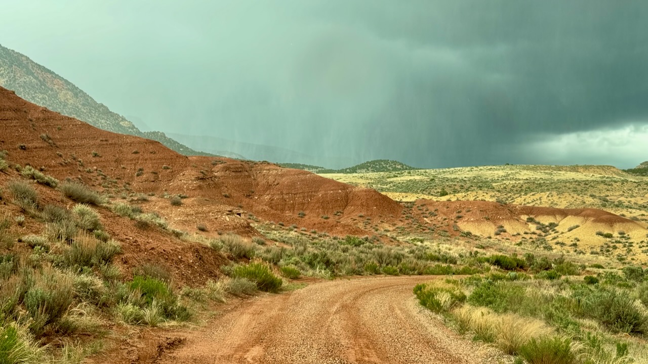
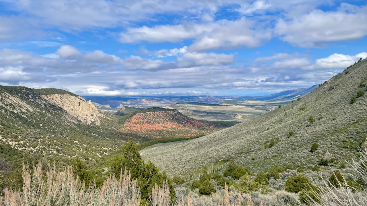
First stop was at the Visitors’ Center in Utah, to get our passport stamp, buy the requisite souvenirs, and enquire about Echo Park Road. The ride into the Visitor’s Center was, of course, gorgeous. (susan here: we wish that the camera would capture it better. The eye sees so much better.)
But why did we need to enquire? Because it had really rained in parts of Vernal yesterday. The dirt here is clay-like and turns slick when wet. We spoke with one camper who almost got stuck. Ironically, they were trying to get to Moonshine Arch.
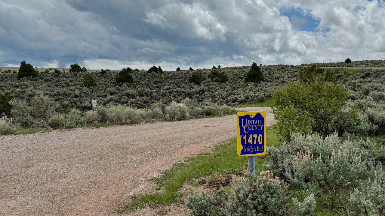
Echo Park is located 38 miles from the Canyon Visitor Center which is near Dinosaur, Colorado. The first 25 miles are on the paved Harpers Corner Road. The last 13 miles requires driving on unpaved roads. These roads are impassable when wet and are recommended for high clearance vehicles only. Right after you leave the Harpers Corner Road, you will descend quickly down several switchbacks. Before heading to the Echo Park area, stop at the visitor center for information on road conditions or call (970) 374-3000.
https://www.nps.gov/dino/planyourvisit/echo-park.htm
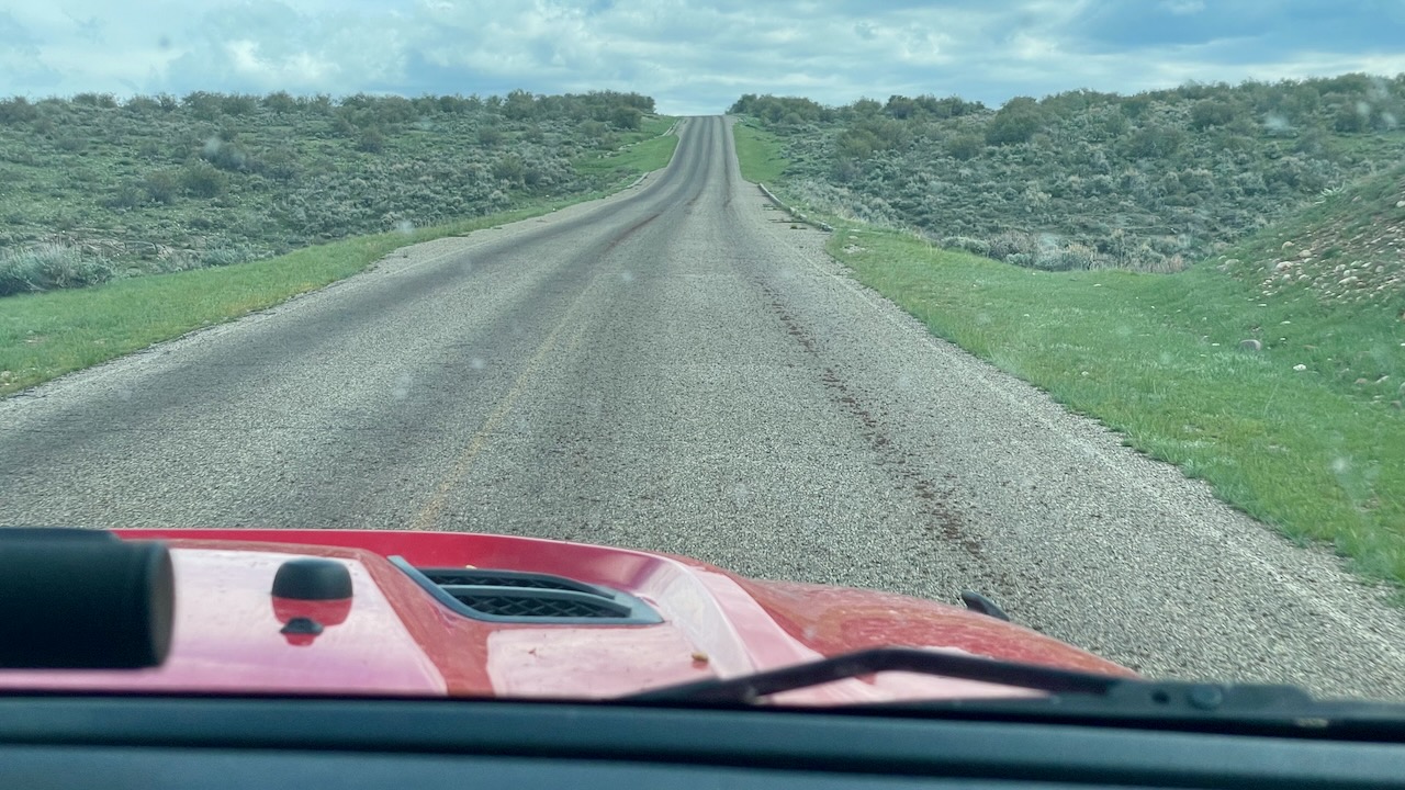
So we did exactly what the NPS told us to do. The ranger checked the log and said we were good to go. So off we went. It looks pretty easy.
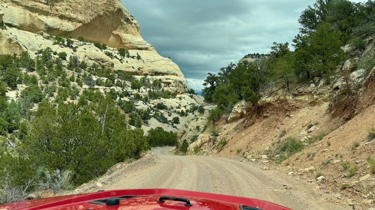
The road is smooth dirt, but it descends rapidly into a series of harrowing switchbacks. Susan asked Paul if he was ok. He’s suffered from vertigo most of his life. It seems to have abated a few years ago, which is great. Paul’s response is the title of today’s blog. Scroll back up, we’ll wait.
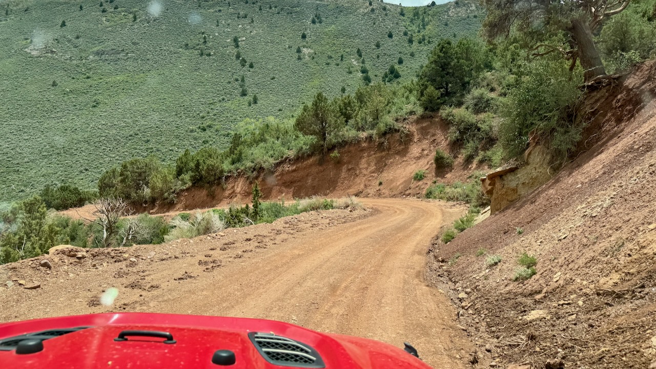
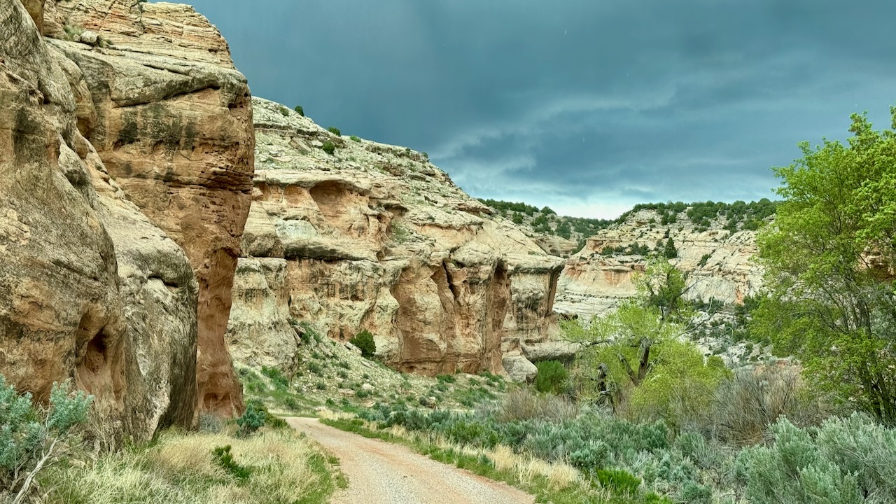
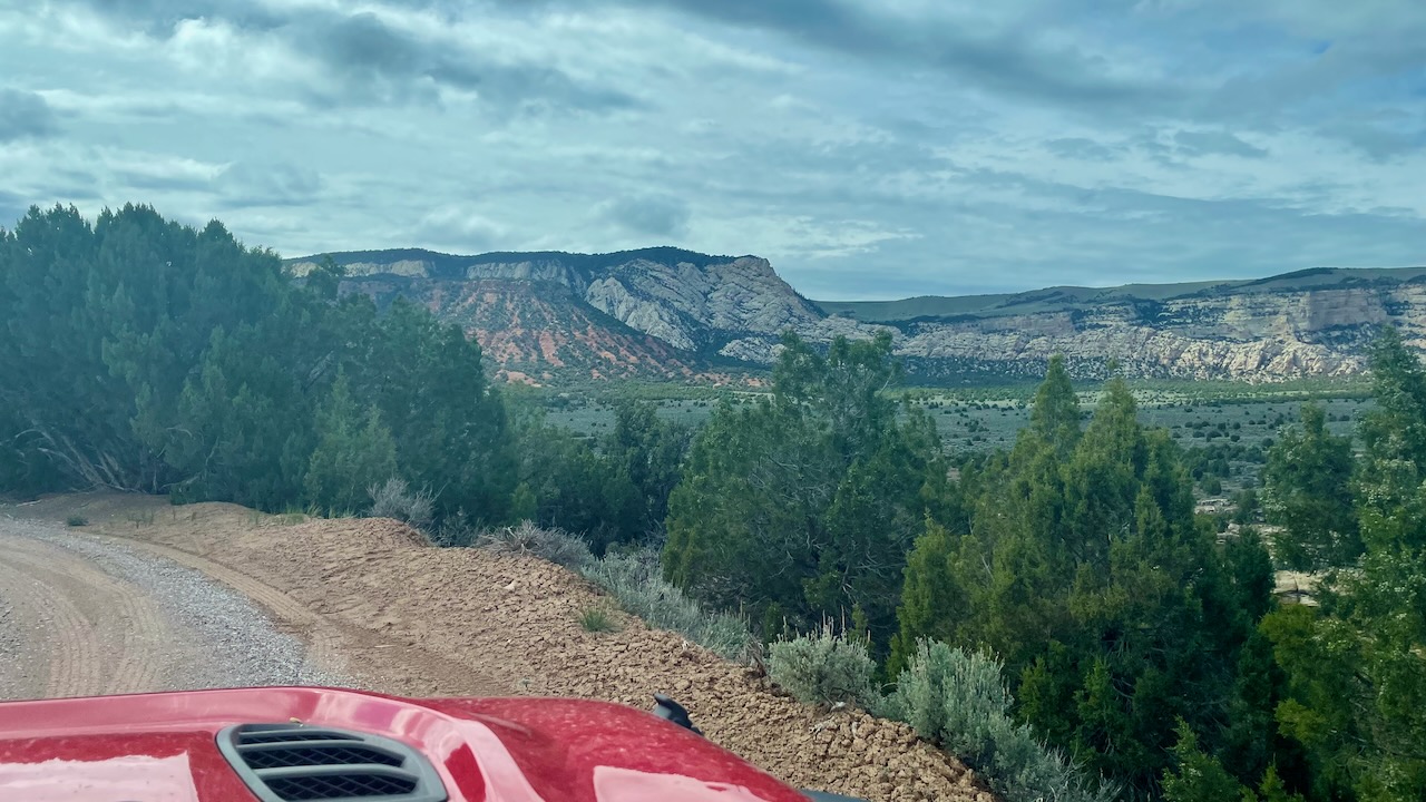
It eventually flattens out and turns into a pretty scenic drive.
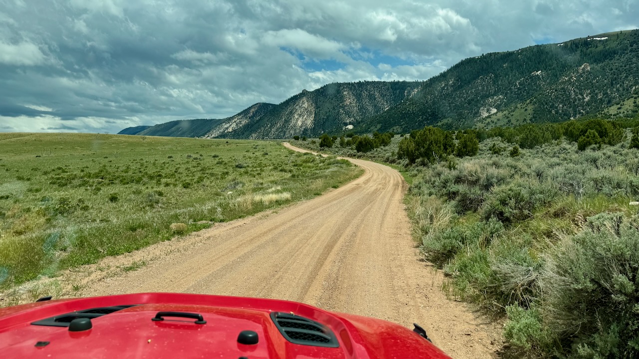
It descends some more, but without the drop offs it isn’t very scary, just beautiful.
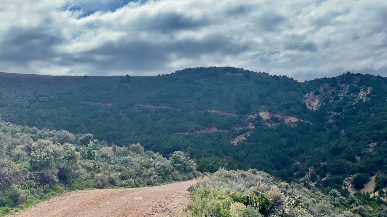
No, not scary at all. Ominous black clouds don’t carry rain that would make the only road out impassable, right?
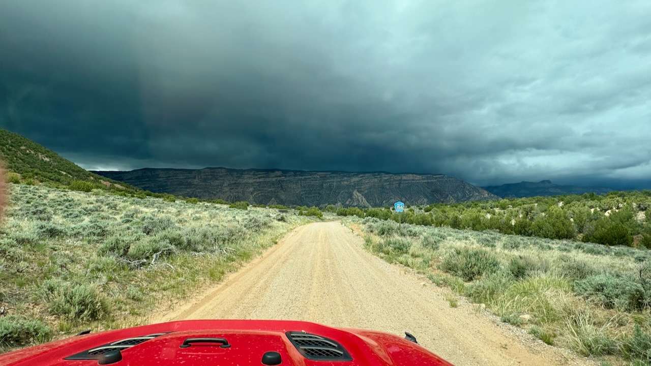
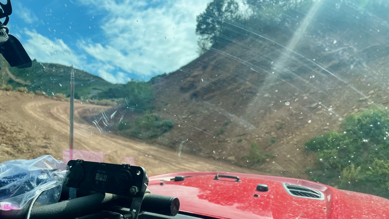
Notice the schmutz on the windshield, that’s Graupel, not quite rain and not quite snow. It was thick enough that we were getting buildup on the wipers, thick frozen yuck.
By this time we were a little worried, worse case we’d spend the night in the Jeep. We had 2 snack bars, and plenty of water (because that’s what you do in the desert). But no sleeping bags (oops!).
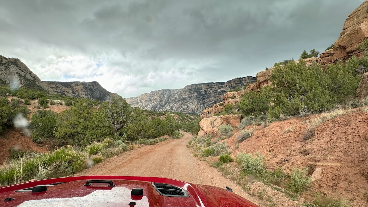
We passed by an old homestead but didn’t stop because we wanted to get to Steamboat Rock, our destination. It’s a mile long, 1000 foot tall peninsula.
Here you can see rain, or the Graupel, falling from the sky. We can’t really tell from this distance.
We make a u-turn and head for safety.
LOL, did you really think we did that? We pressed on!
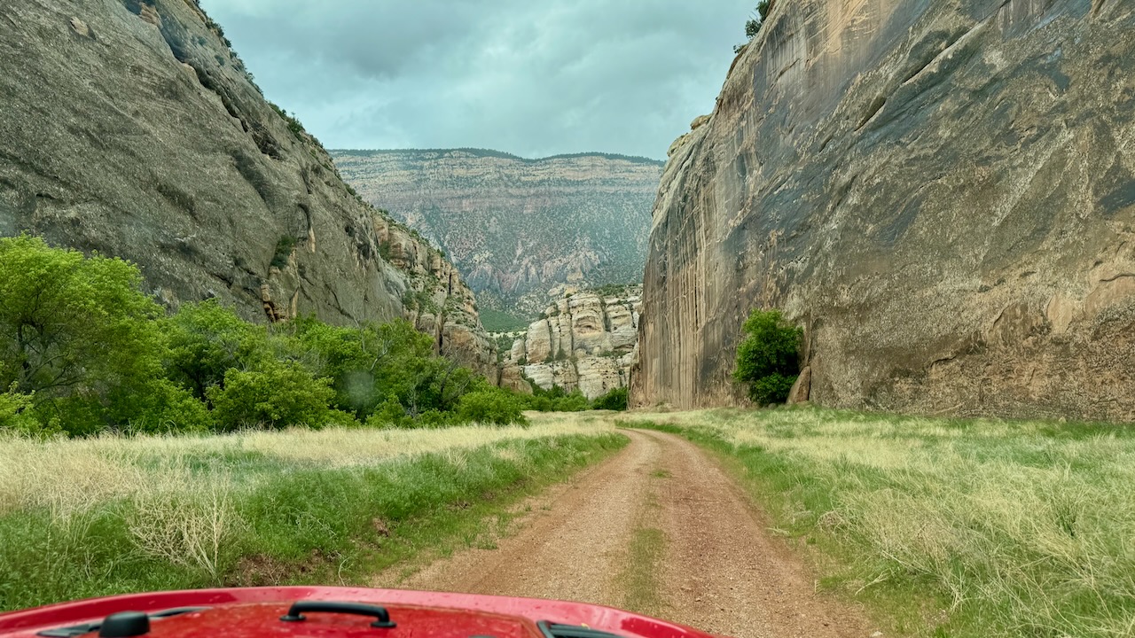
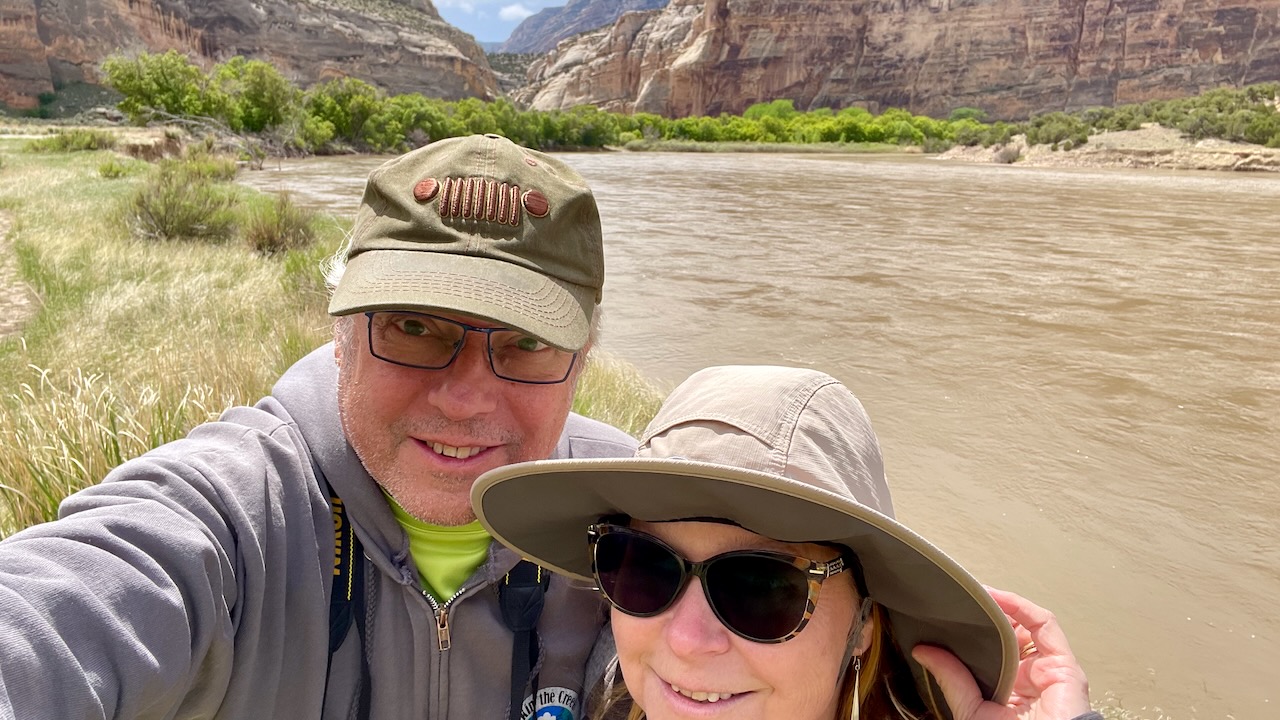
And soon the Steamboat Rock was in sight!
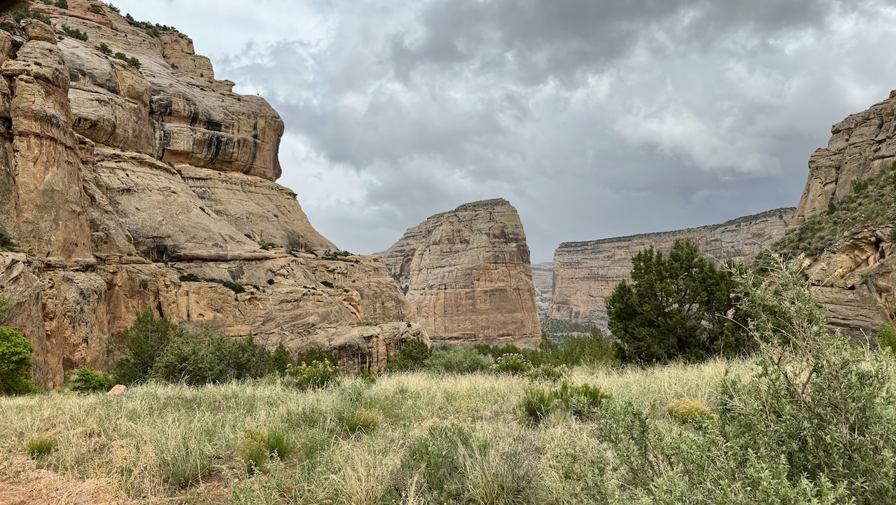
And to celebrate our arrival, the sky cleared.
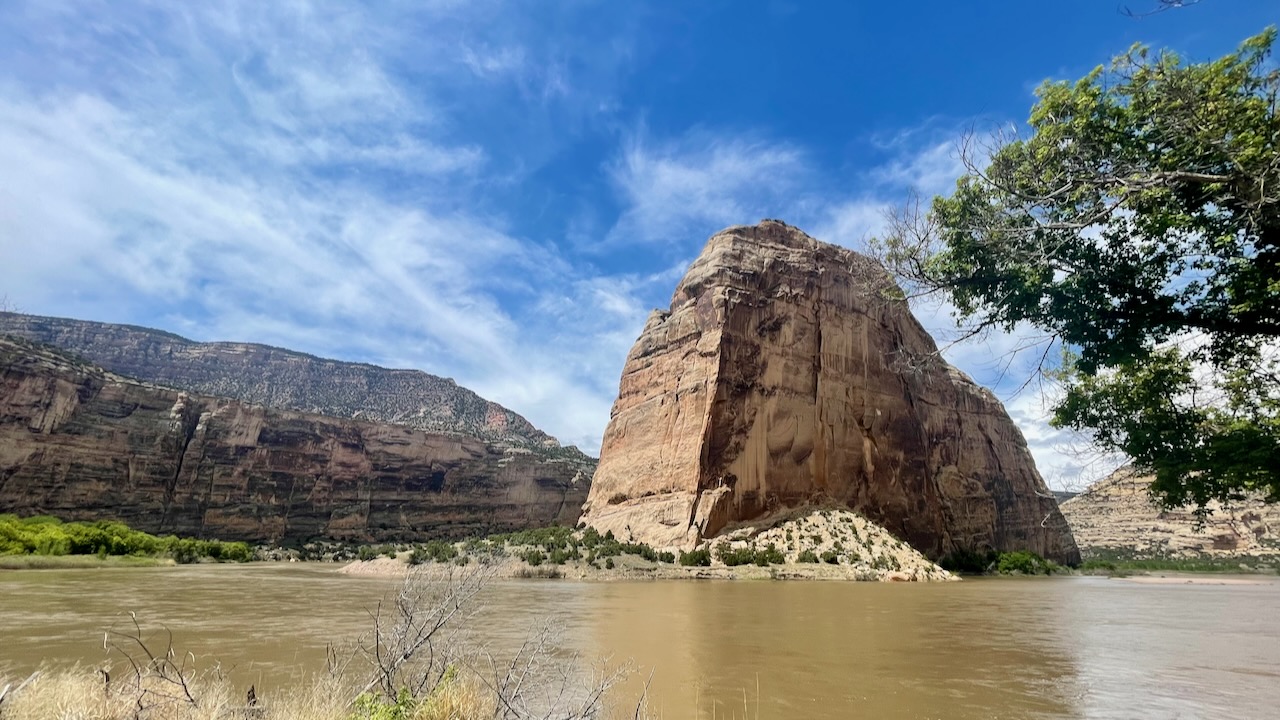
This is just another one of the many super scenic ox-bows that dot the canyons of the west. It is cool to think how many millions of years were needed to carve this out. To say it’s massive is an understatement. Think of the biggest buildings on Earth. At 1000′ tall and over mile long, it’s bigger than the tallest skyscraper and sits at the confluence of the Green and Yampa Rivers. BTW, the Green River isn’t all that green. It’s probably named that for the lush vegetation that grows along its banks. It was pretty windy, too.
We found NH on the way out.
We looked at Echo State Park on the way out. The primitive sites were really nice, but not for an RV like ours. That’s if we could even get the RV down there (we can’t). The big find was discovering the place was filled with birds. We got our gear out and just watched them for awhile.
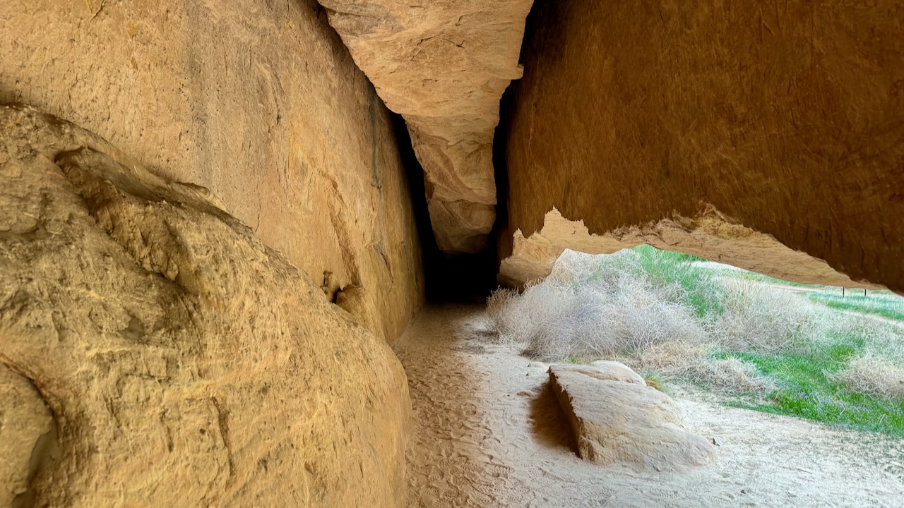
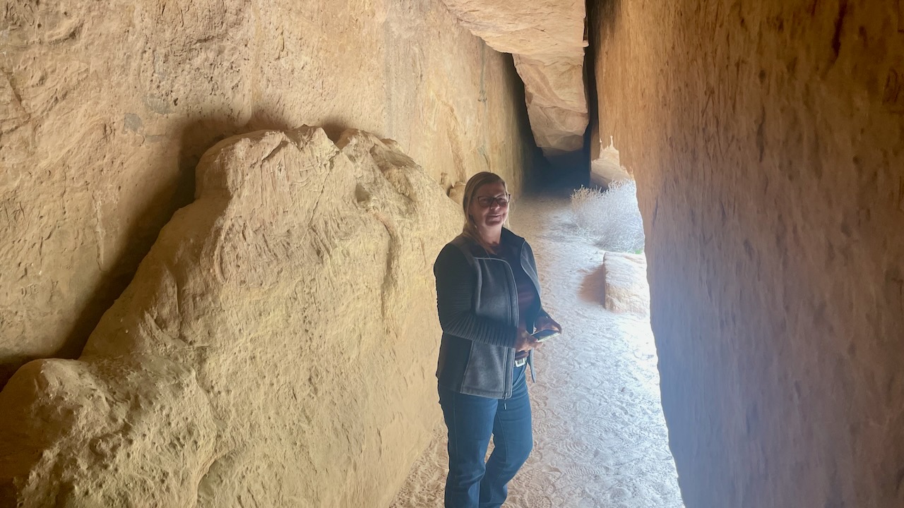
On the drive out of the canyon we stopped at all the places we missed on the way down. First was Whispering Cave. We never did look up why it is called that. But there was this gash/cave at the base of a sheer cliff. It was pretty cool inside, but no whispers or even echos. (susan here: I just looked it up. The NPS only states that it’s a cool and shady spot.)
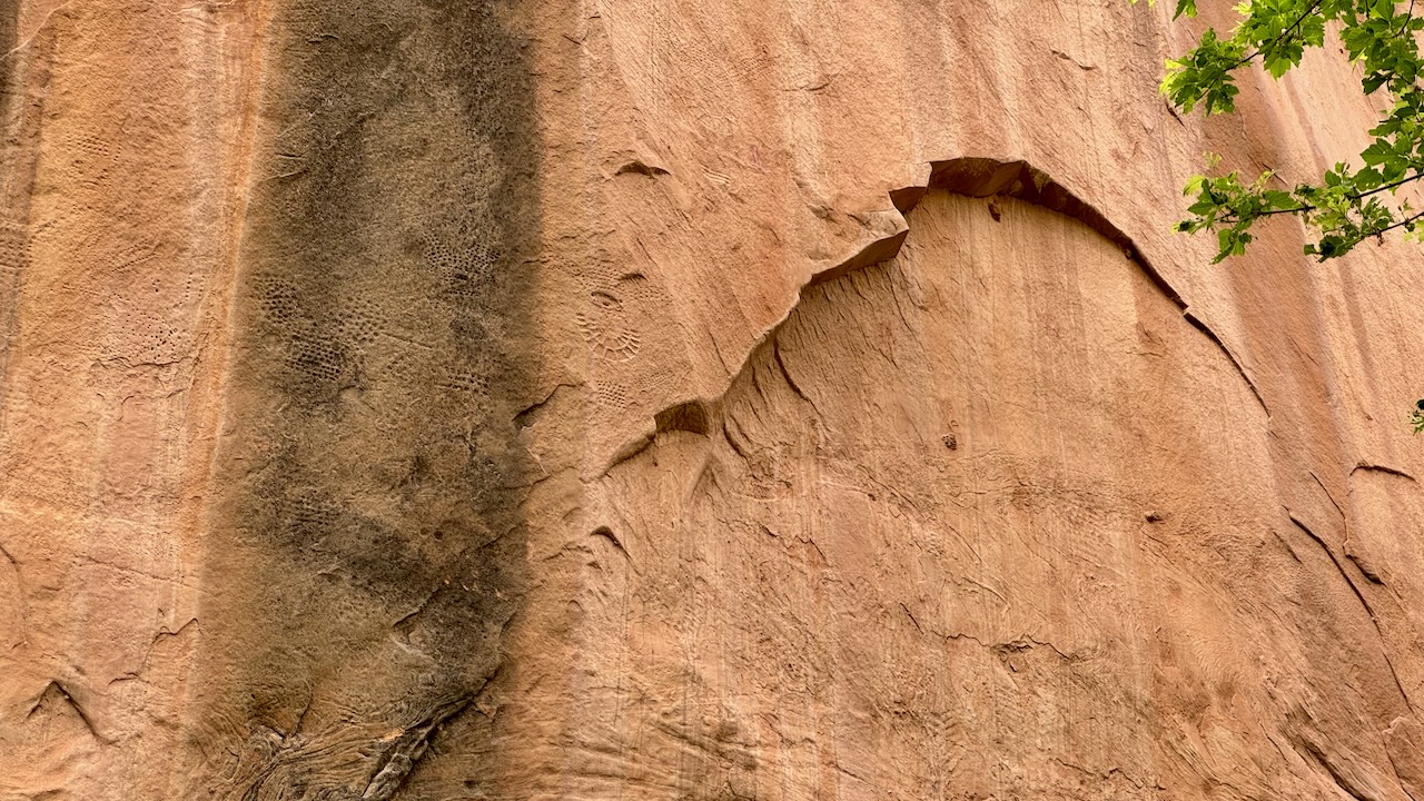
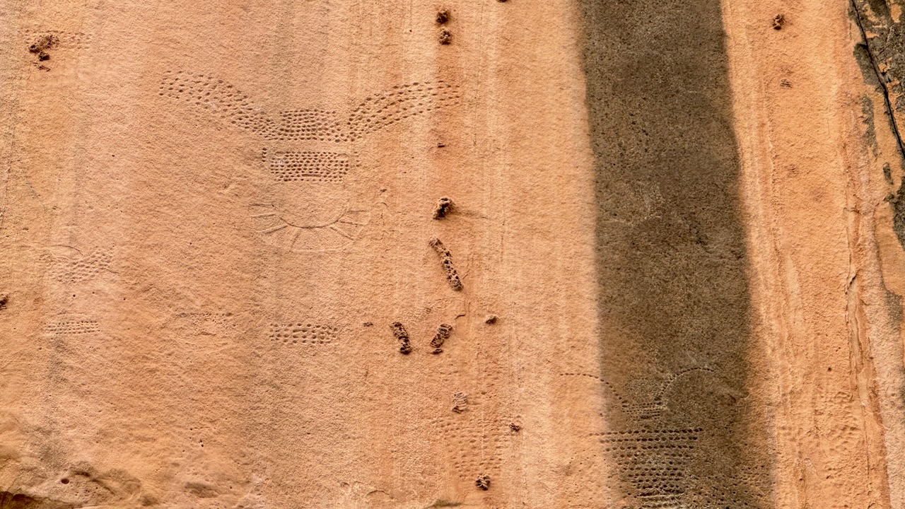
Next up was some more petroglyphs.
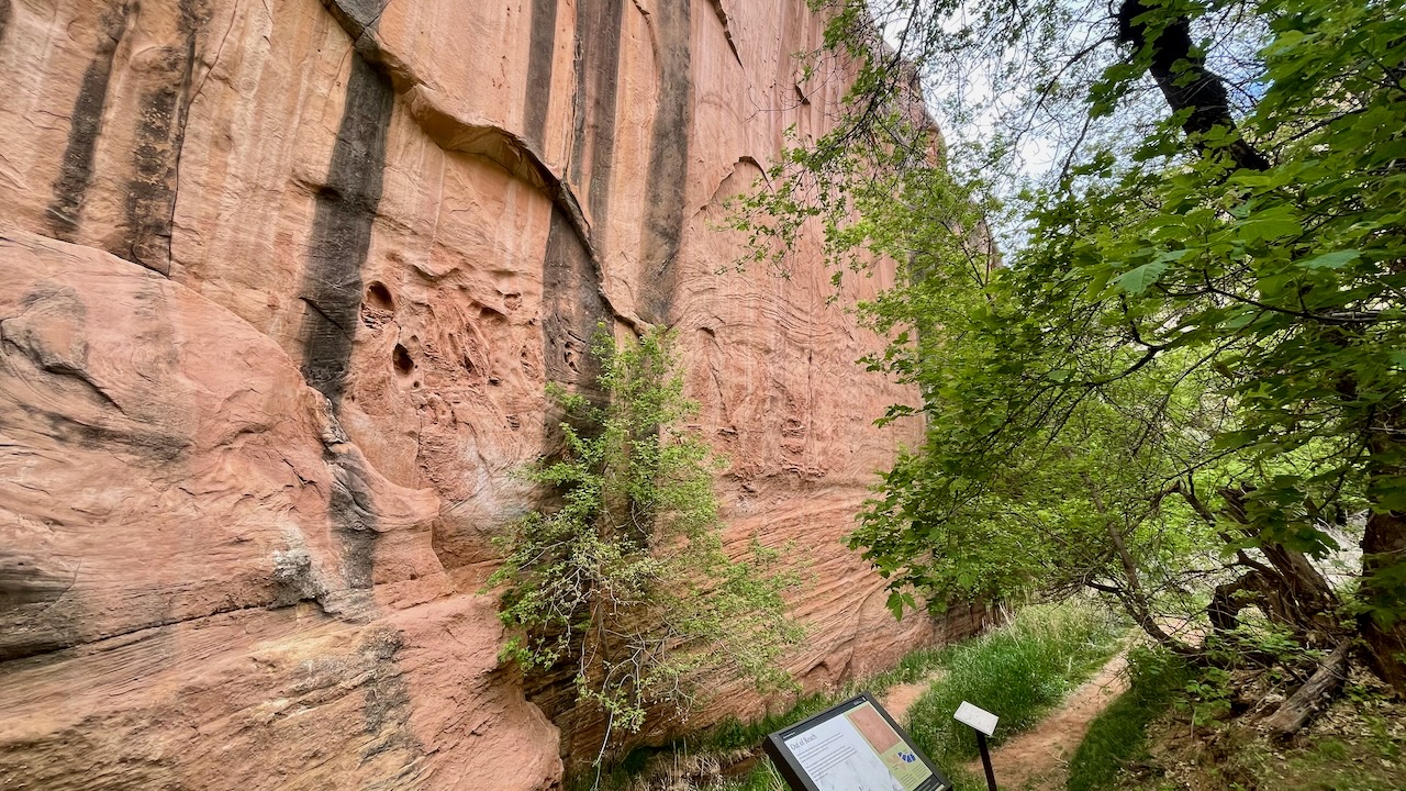
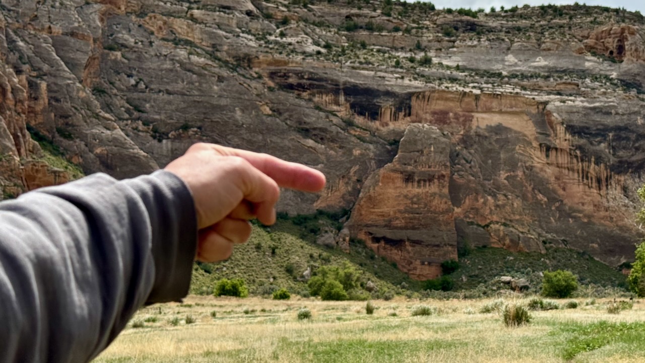
Out of Reach
Carved into the cliff face high above are several human-like figures, each with what appear to be elaborate headdresses or necklaces. Approximately a thousand years ago, the Fremont people created these petroglyphs. How did they do it?
Today the petroglyphs are inaccessible, but this wasn’t always the case. When the Fremont made these images, the ground surface extended to the level of the petroglyphs, approximately 35 feet up the cliff face. Over the last thousand years, the water flowing in the creek channel on the west side of this canyon has eroded that access, leaving the petroglyphs high above human reach.
Where are they? Look right above the tree that is against the cliff.
On our way we passed a dilapidated old cabin that made for a pretty picture.
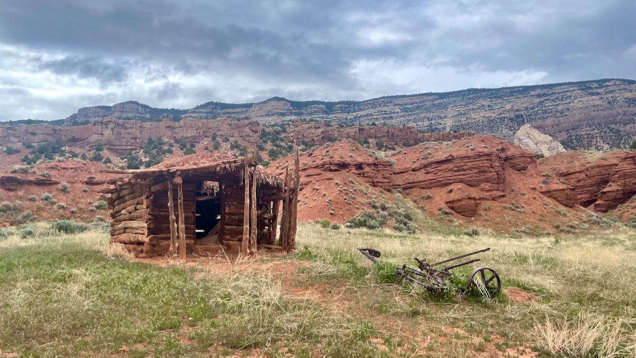
It is really difficult for us to picture how hard it must have been to live in those times. Impossible really. Clearly they were rugged, industrious and resilient people.
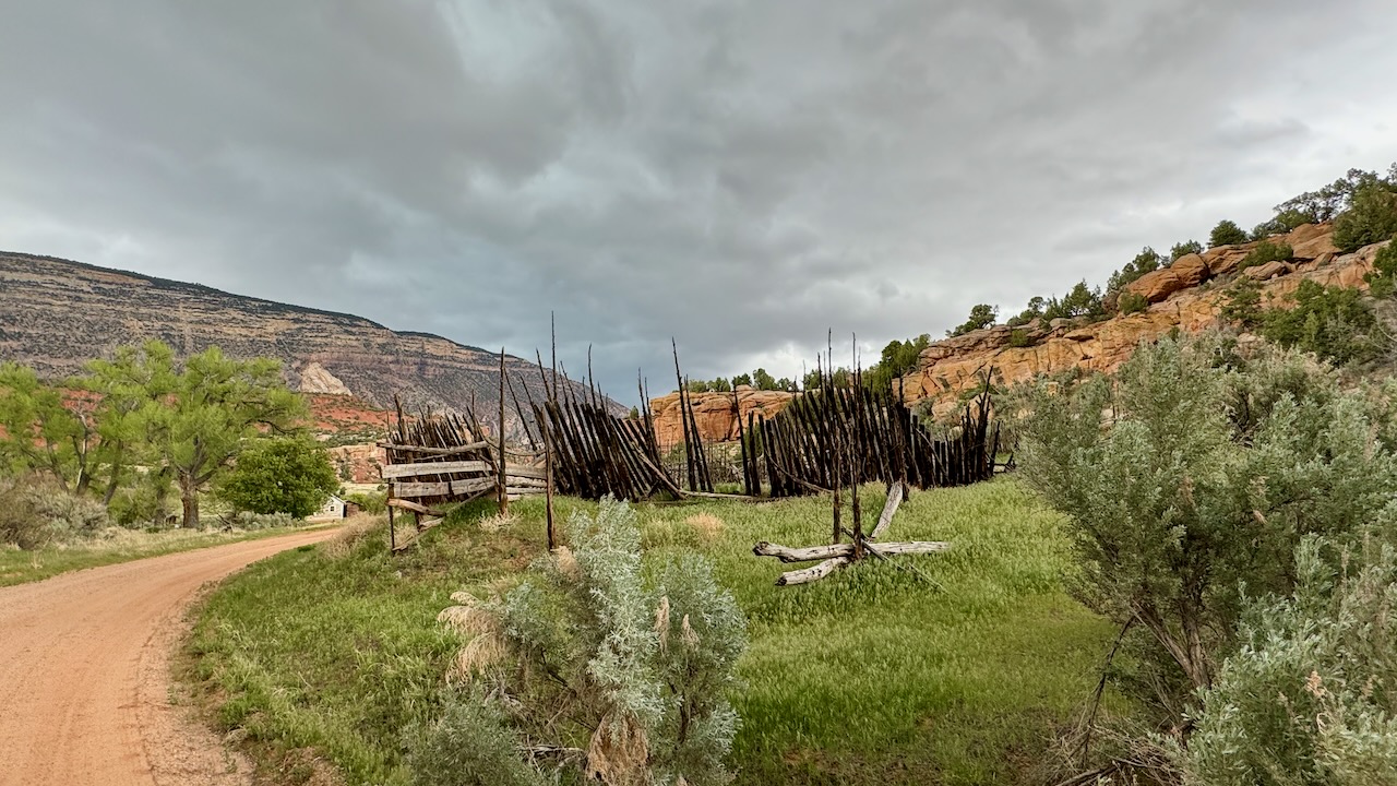
Winding our way out, we stopped at the Chew Homestead.
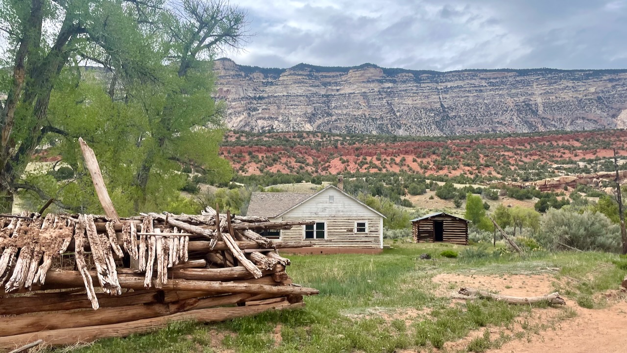
Jack Chew was searching for a good home for both his family and his cattle. He found it here at Pool Creek, one of the first ranches established in what is now Dinosaur National Monument, and home to three generations of Chews.
When the Chews arrived, there were just the raw materials of a promising future. Pool Creek provided water, nearby areas offered good winter grazing, and trees in the surrounding mountains supplied timber.
For the Chews and others who homesteaded this rugged, arid landscape, self-reliance was as necessary as water.
The Chews established orchards, planted gardens, and dug irrigation ditches. With hard work and nature’s resources, the Chews made a home that sustained them for more than half a century.
from a plaque on the site
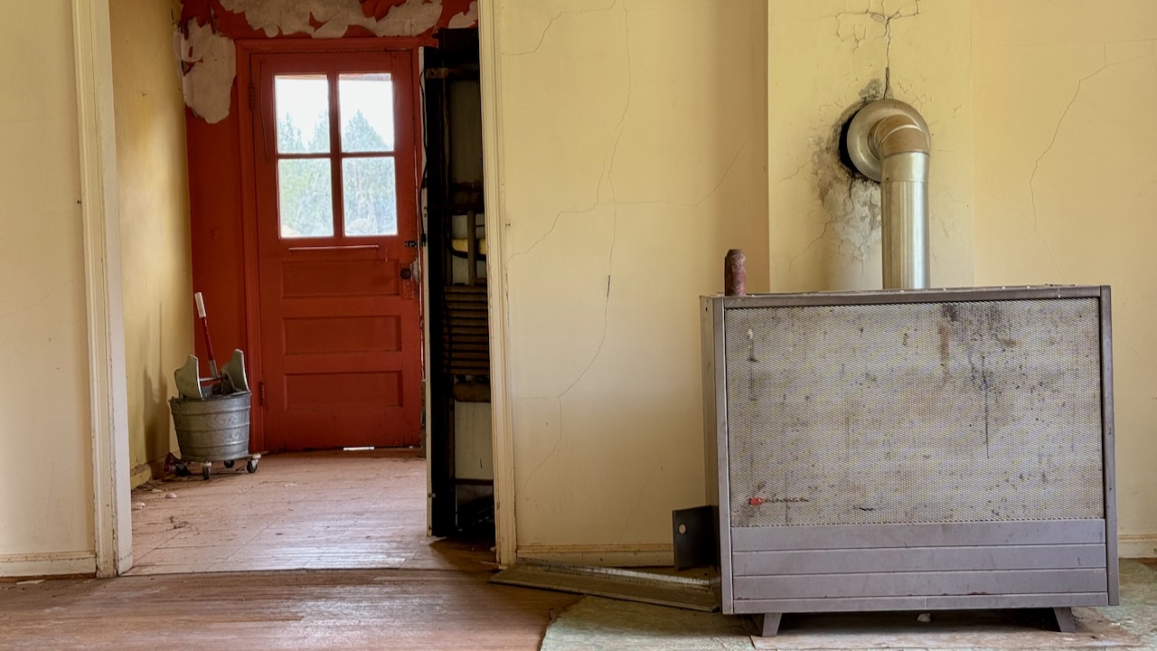
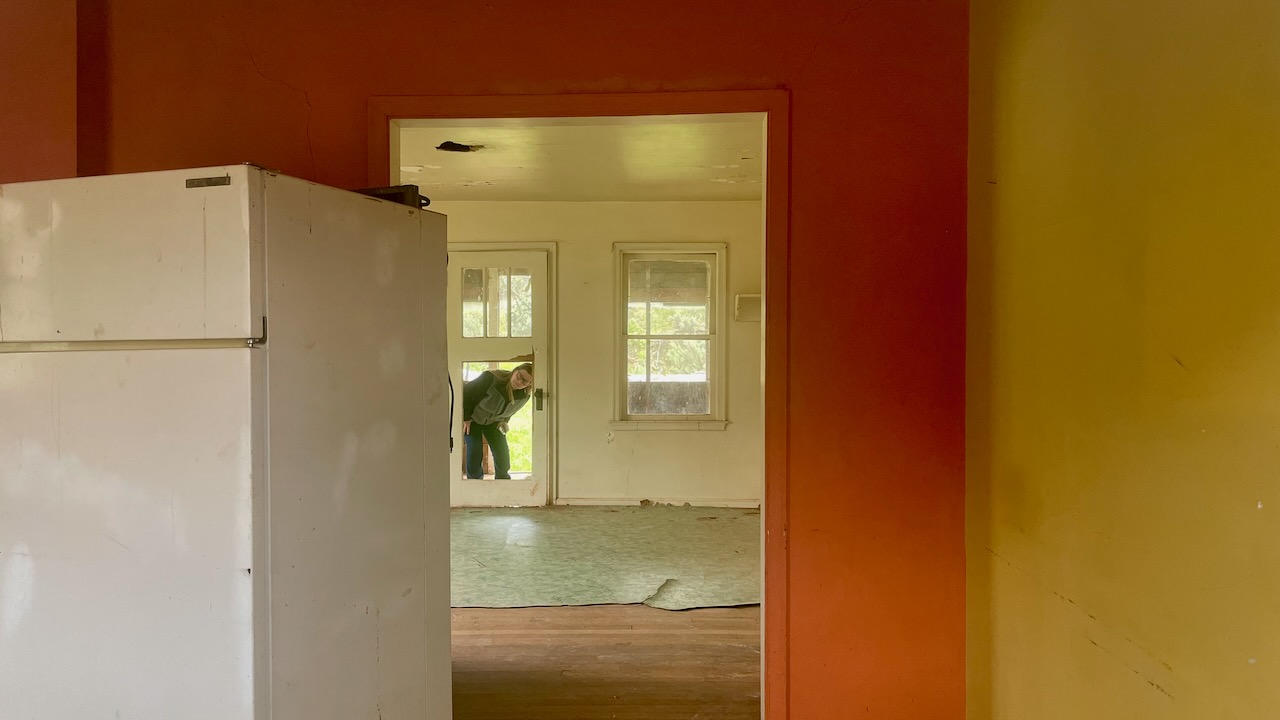
The Chews had a nice house!
We even saw the common “metal” Connestoga Wagon.
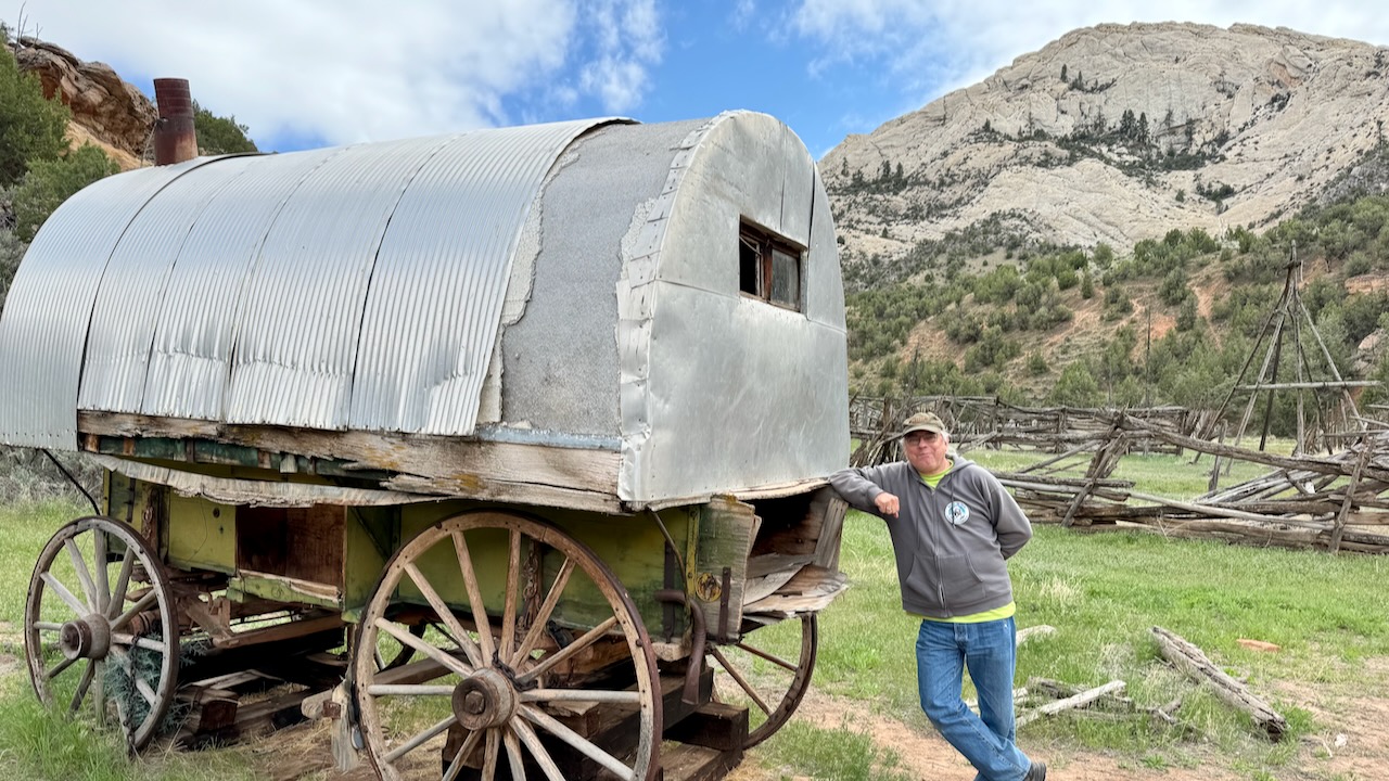
We’ve seen a few, all metal. We can only guess that the metal is used to show the shape and how small they were. Plus, it’s way easier to maintain than canvas!
We’re working our way up the switchbacks. This time Susan was driving and Paul got to enjoy the very vertical views downward.
You can see just how the road rises.
At the top we could look out into the canyon where we had just been. Hmm, why didn’t one of use get out of the car to show the switchbacks from above?
Let’s back up a bit. On the way to Echo Canyon we saw vague red stripes on the pavement but couldn’t figure why. On the way out, we got a photo.
Those are Mormon Crickets, some dead and lots of them still hopping. They’re 2-3″ long and swarm by the millions. This year, 2024, is a banner year (lucky us). That scenic overlook we should have gotten pictures at? It was covered with them, thousands of them hoping all around. We left pretty fast. BTW if there are enough squashed bugs it makes for slippery driving. (susan here: the sheer numbers of them hopping on the road surface was thoroughly disgusting.)
Much better than crickets are pretty cows. Did we mention that we were on open range? That means no fences and the cattle are free to move about and even cross the road. This pretty girl wasn’t much more than 10′ from the edge of the road.
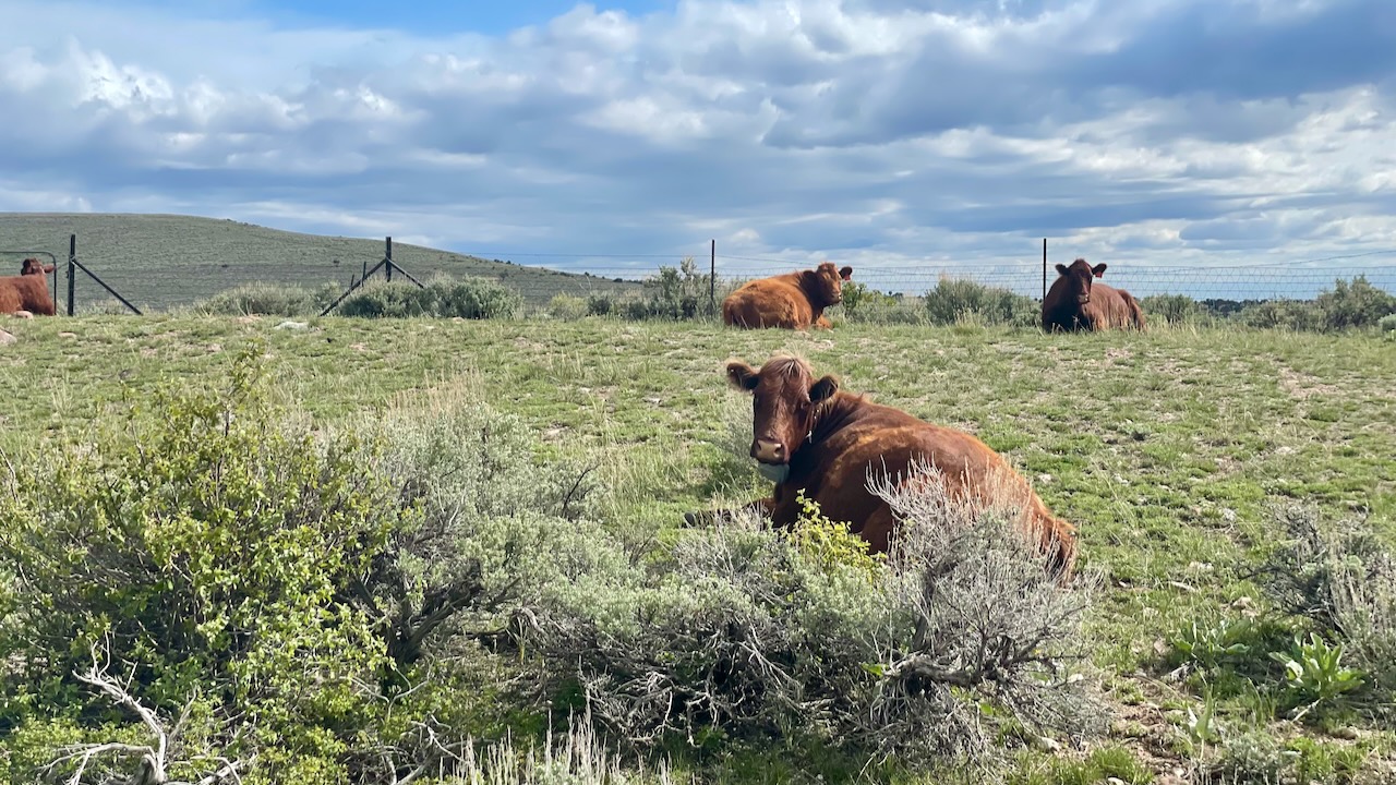
We’re guessing that these few were waiting for the rancher to let them in for milking, or dinner, or something.
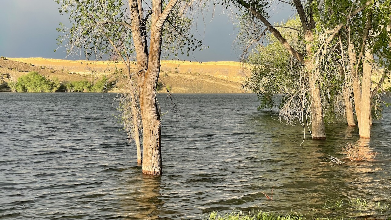
Back at the campground the setting sun made for brilliant landscape and contrasted with another storm coming in. It sure is pretty at Steinaker State Park. MUCH nicer than the KOA in town.
Life Birds: 3 (Warbling Vireo, Western Tanager and House Wren, yes, the House Wren, somehow Paul never got around to adding this common guy to his list!)