More Dinosaurs!
May 21, 2024 — Day 67
Steinaker State Park, Vernal, UT
Today we went back to the Dinosaur National Monument to see the wall of dinosaur bones as well as explore the parts of the park closer to Utah.
But, before we even headed out we had a problem. The slow leak in the Jeep’s tire had become a fast leak. We had been loosing about 1psi every few days. After we had topped it up the previous day overnight we lost 11 psi. That’s too much of a drop. We found a tire place that appeared to have good reviews and headed over. We sat in the waiting room for an hour or so while they fixed it. For free! Thanks to TJ’s Tires in Vernal, UT for saving the day!
This time we chose to drive the scenic route to the Monument. And what a ride it was. It was across some open range, full of rolling hills. First sign of life was this single house.
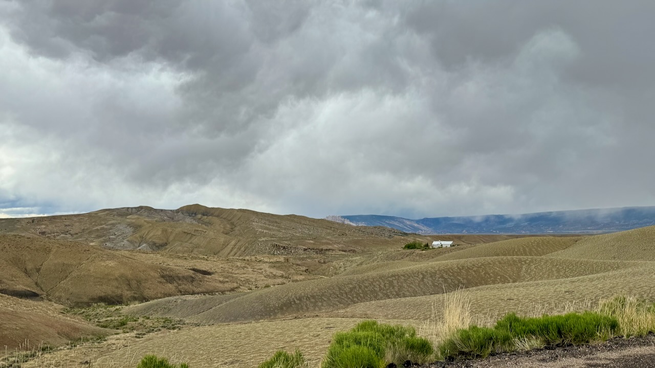
This must have been the suburbs, soon we came to a small group of houses.But that lone one was really out there. (The photo was taken at 40.43966° N, 109.40777° W if you care to look at it with satellite view.)
We boarded this cute little shuttle bus for the ride up to Dinosaur’s Quarry Exhibit Hall.
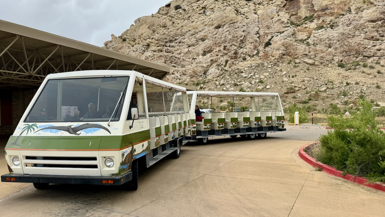
Did we mention it was cold? We both had our light winter jackets on, but the breeze from the drive really chilled us.
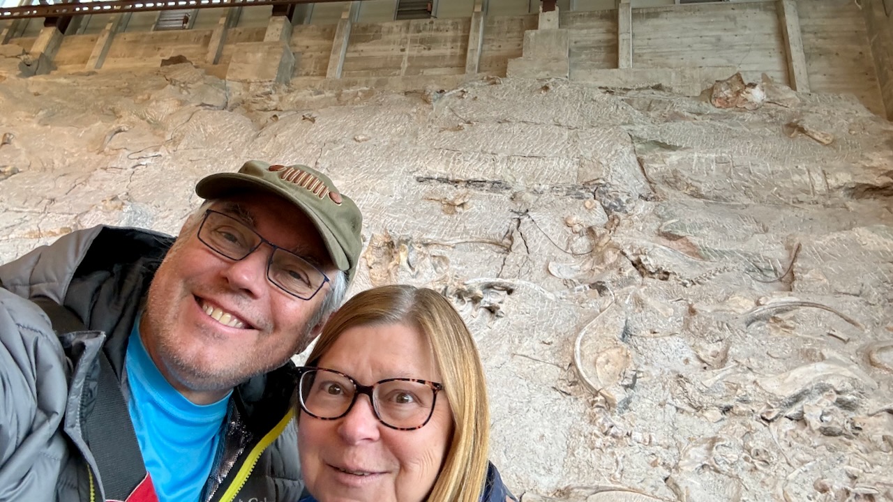
After a short ride we got to the Quarry Exhibit Hall. It’s a new building. The original one had been falling down since the soil shifts a lot out here. When you walk in you see the wall full of dinosaur fossils, about 1500 of them in fact. It took your breath away.
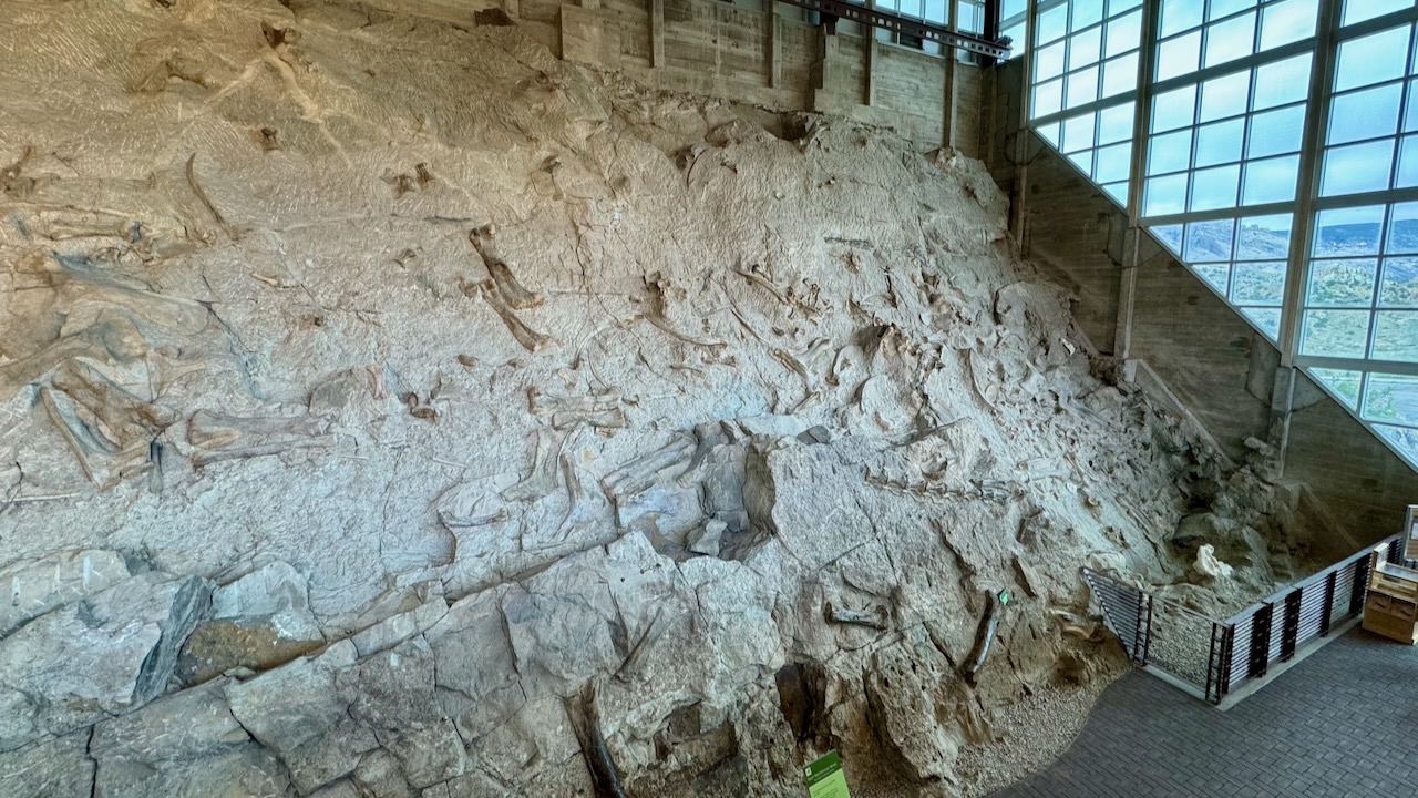
That picture is only about a third of it. What is the wall?
The Quarry Exhibit Hall is a large indoor building with glass windows that provide sweeping views of the landscape. Outside, you can see part of a geological anticline (uplift) with many rock layers exposed at an angle. One of these layers, the Morrison Formation, is also exposed inside the Quarry Exhibit Hall. This section contains over 1,500 fossilized bones of dinosaurs from the Late Jurassic Period, approximately 150 million years old. There are 8 different species of dinosaur remaining in the Quarry Wall, including a few fan favorites like Stegosaurus and Allosaurus. Some of the skeletons are articulated (connected in the right order), but most of them are loose and unconnected. A few even bear signs of scavenging.
https://www.nps.gov/dino/planyourvisit/quarry-exhibit-hall.htm
And how did it come to be? Why weren’t all the fossils taken away? That has to do with the original founder, Earl Douglass, who was working for Andrew Cargnegie. He saw value in preserving part of the wall for posterity.
“I hope that the Government, for the benefit of science and the people, will uncover a large area, leave the bones and skeletons in relief and house them. It would make one of the most astounding and instructive sights imaginable.” — Earl Douglass
https://home.nps.gov/dino/learn/historyculture/carnegie_quarry.htm
That second link goes into great detail about the quarry, from its discovery to the excavations to the creation of the Exhibit Hall.
Enough history! Let’s see some bones!
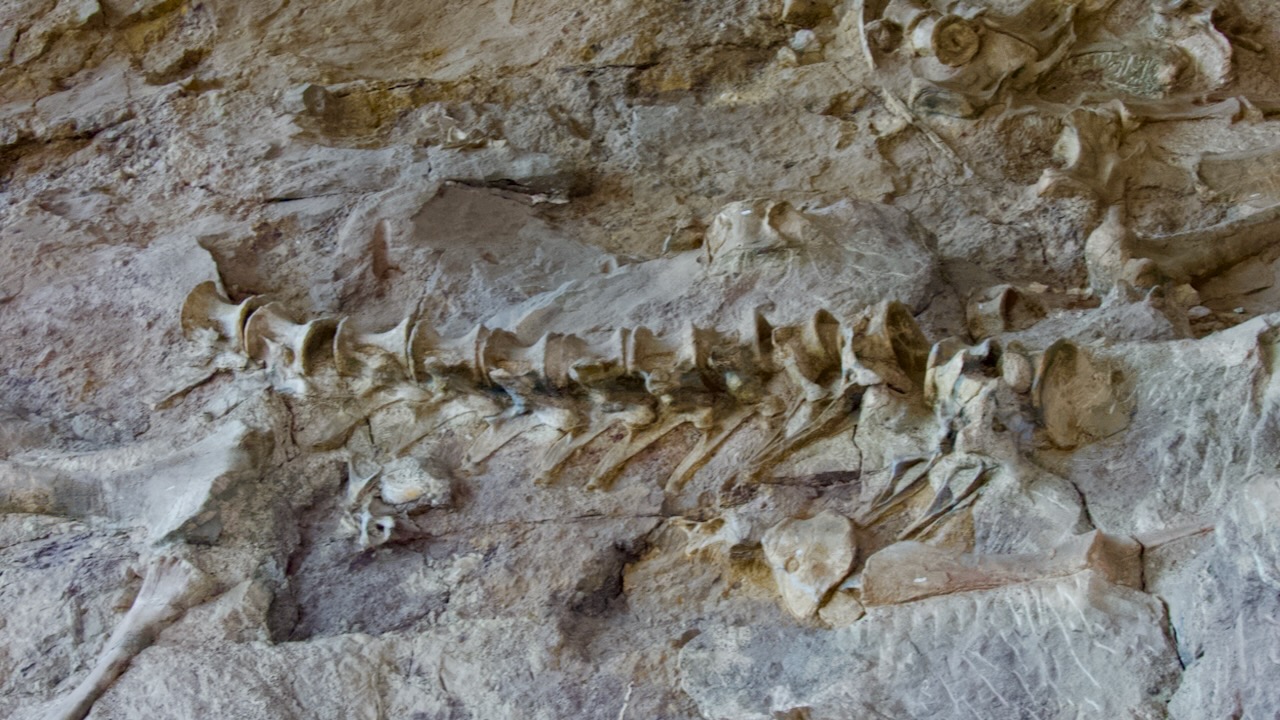
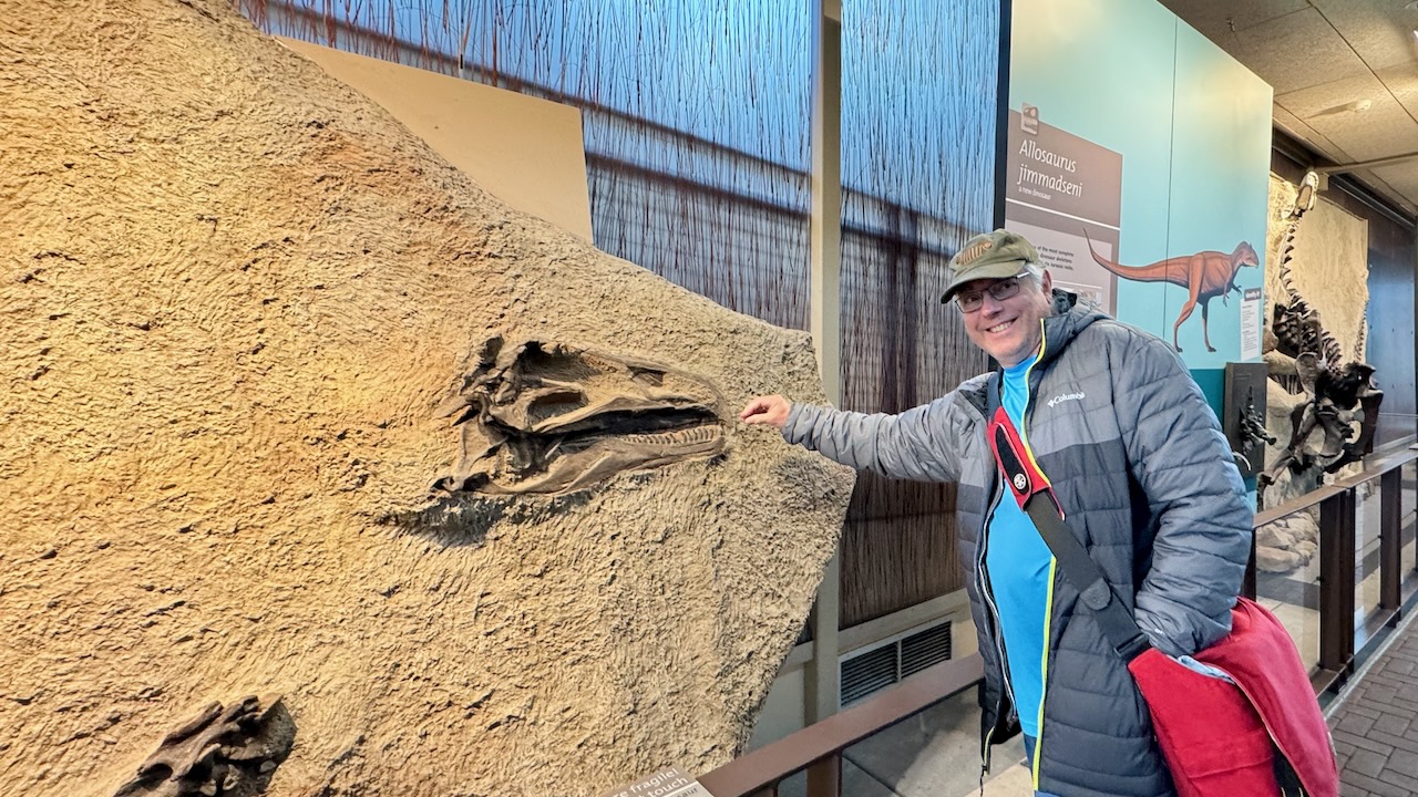
Why were they here? Hundreds of millions of years ago this was a wet place. There was a giant river and sometimes critters died near the water. Flood waters would carry them downstream where they would be deposited in the “logjam” at the outside of an oxbow. That’s why they are piled up in a jumble.
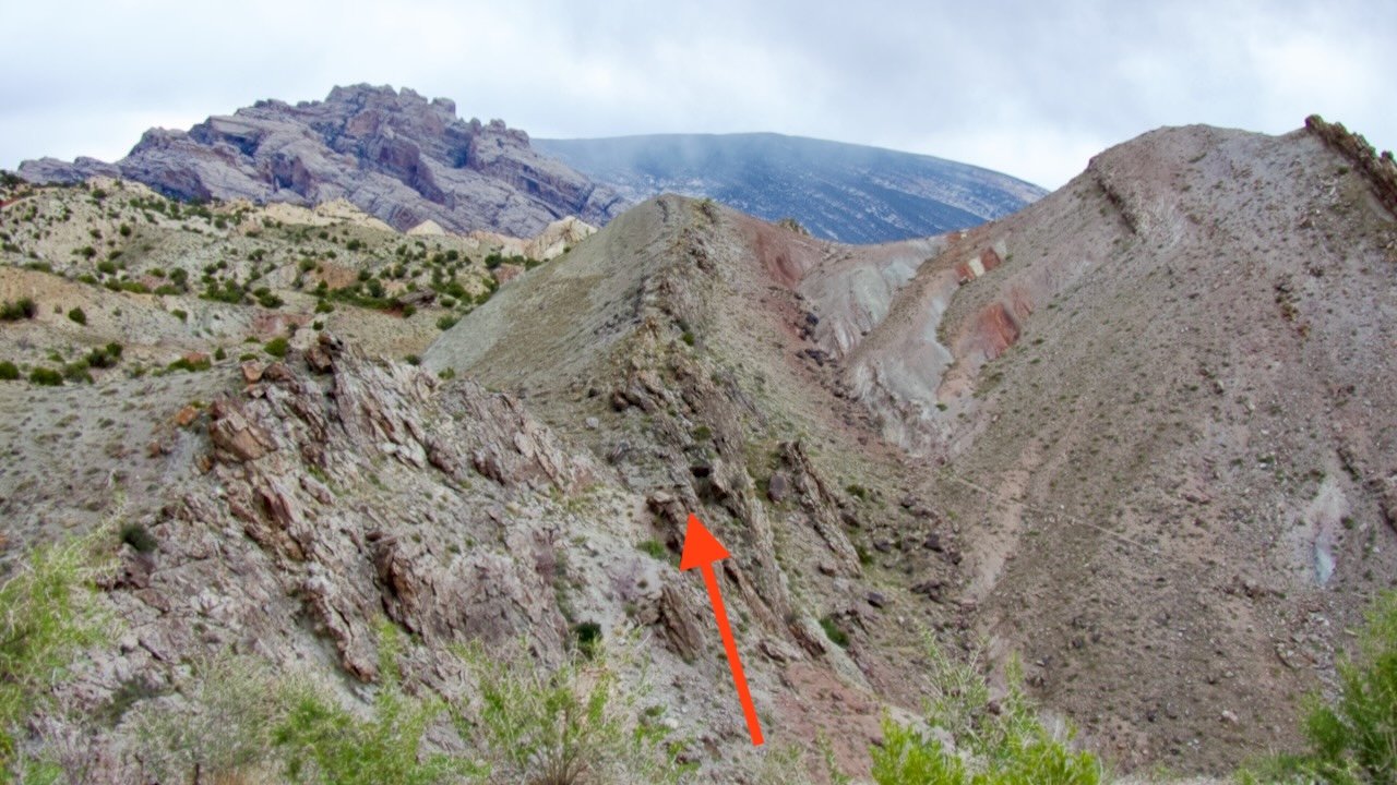
Eventually they petrified and tectonic forces shifted the plates. The plate is fairly thin here. I asked the ranger if there would be more fossils if they had dug deeper, no, they replied, because of the thinness of the layer. He directed our view out the window, that’s the layer he said. (It didn’t have the red arrow on it in real life.)
There was a hike back down to the Visitors’ Center. It was almost all downhill, made of graded gravel, but the odd thing is, signs disagreed on how long it was, it was either 0.7 miles, 1.2 miles, or 1.4 miles. Our guess is that it was 0.7 miles and the sign makers put “round trip” on the 0.7 miles accidentally. But, it was cold and very windy. We decline to walk it down which was just as well since it just started drizzling.
We headed off to explore more of the Utah side of the park. First stop was an overlook to peer down into a campground we almost booked.
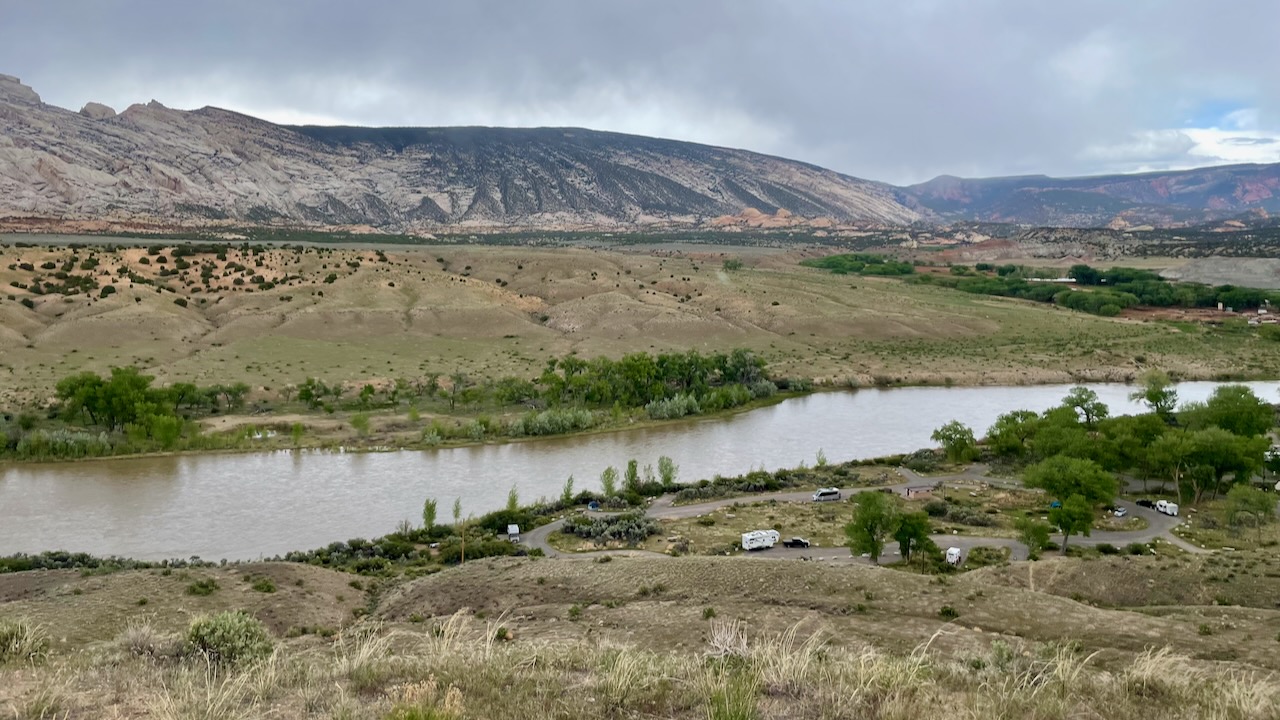
Booking a site here would have saved us a half hour each way when visiting the Monument. But, the sites here did not have power. When we booked the KOA we were worried about needing power for our ACs. Ha! Later in the day we drove though the campground. Only the tent sites had water views and very few of the sites could accommodate a large RV. We’re glad we didn’t book it.
Next up is Turtle Rock.
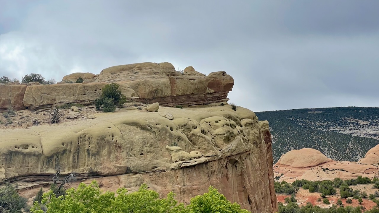
It’s easy to see the turtle! But the guide app didn’t prepare us for the turtle resting calmly on the skulls of all its victims!
Next up, petrified sand dunes!
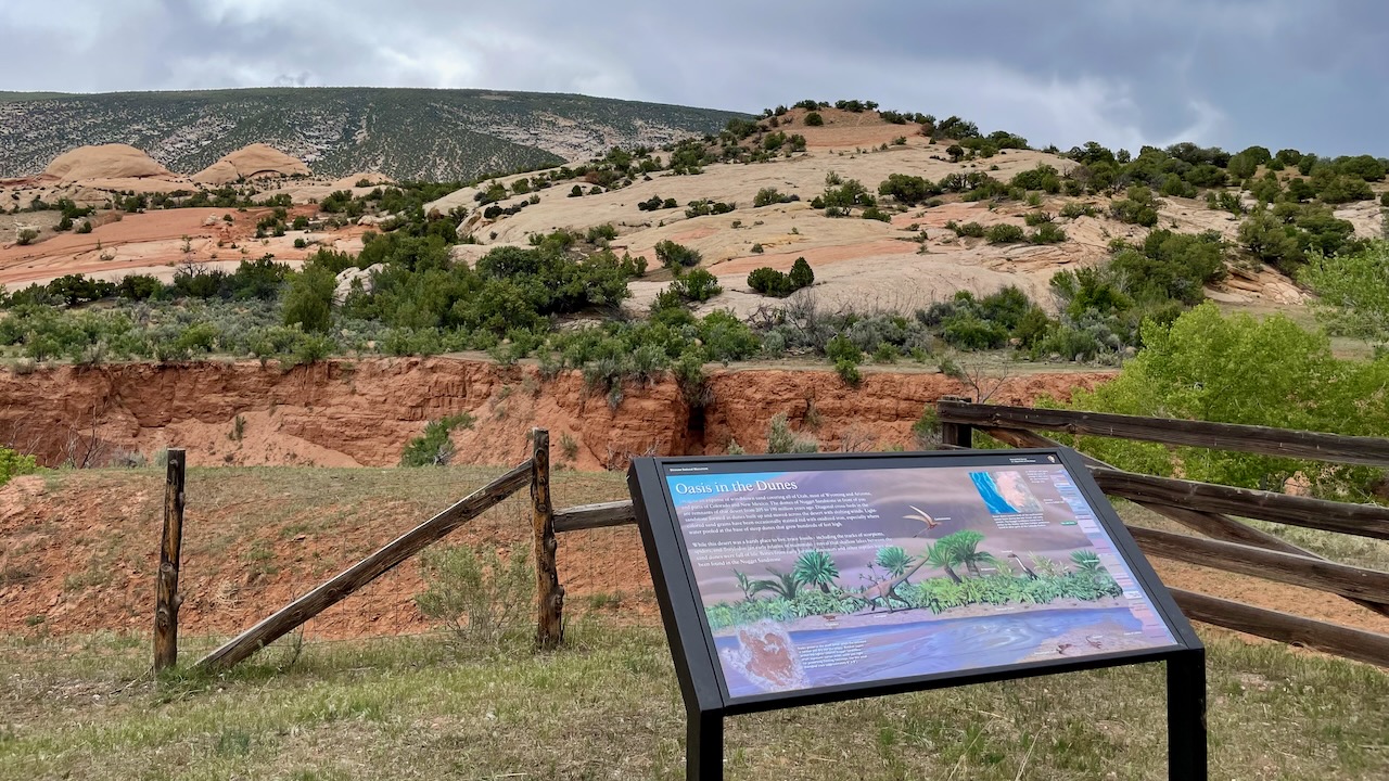
We had read about these in the museum in Vernal, and had even seen some, but this photo really captures them.
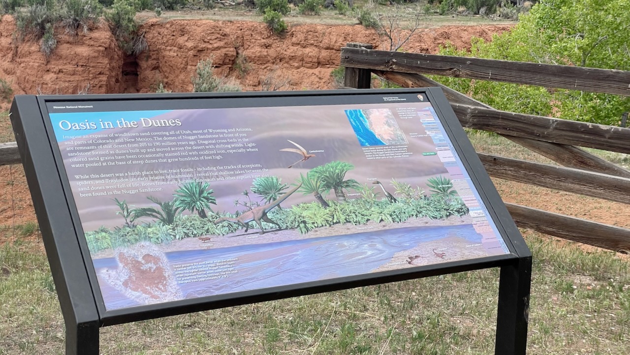
Imagine an expanse of windblown sand covering all of Utah, most of Wyoming and Arizona, and parts of Colorado and New Mexico. The domes of Nugget Sandstone in front of you are remnants of that desert from 205 to 190 million years ago. Diagonal cross-beds in the sandstone formed as dunes built up and moved across the desert with shifting winds. Light-colored sand grains have been occasionally stained red with oxidized iron, especially where water pooled at the base of steep dunes that grew hundreds of feet high.
While this desert was a harsh place to live, trace fossils – including the tracks of scorpions, spiders, and Tritylodon (an early relative of mammals) – reveal that shallow lakes between the sand dunes were full of life. Bones from early Jurassic dinosaurs and other reptiles hay been found in the Nugget Sandstone.
The end of the road was the Josie Morris homestead. It was built with the help of Fred McKnight and the Chew family (they’re the ones that sold land to the NPS to create Dinosaur National Monument, and we saw their place the previous day).
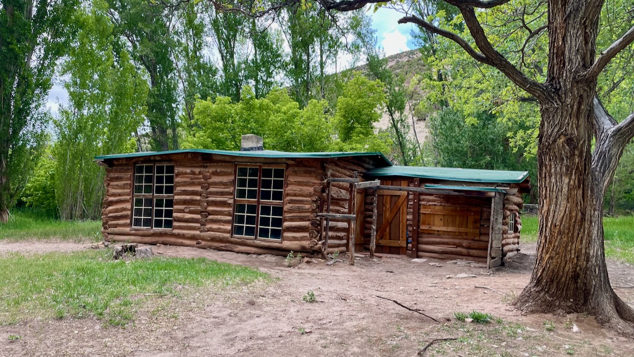
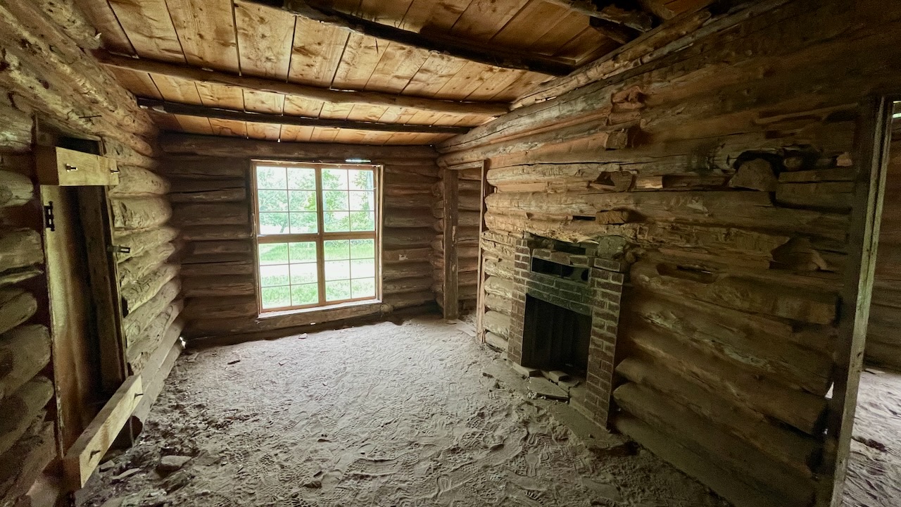
Old homesteads are scattered throughout Dinosaur National Monument, each a memorial to hope and hard work. This cabin and the nearby structures are part of the homestead established by Josie Bassett Morris in the early 1900s.
Nearing 40 years of age, divorced and with her children grown, Josie wanted a home of her own. She chose this spot for its plentiful water and good pasture, the natural resources necessary to grow fruits and vegetables and raise cattle.
Braided rugs softened the cabin floors, handmade quilts warmed the beds, and Josie’s favorite pictures hung on wallpapered walls. In summer, beds of cosmos, marigolds, and poppies ringed the cabin. Family and friends from Vernal often visited.
There was always lots of work and never much money, but life at Cub Creek suited Josie’s independent spirit. She lived in this cabin until shortly before her death in 1964 at age 90.
There was a short hike into a Box Canyon where she would paddock her cattle. A Box Canyon is perfect for this since it only has one exit.
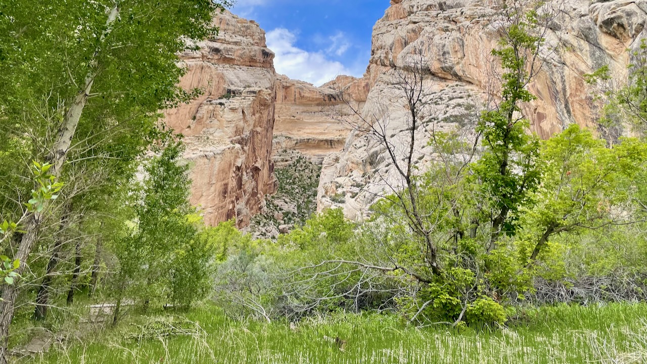
We were surprised at how green and lush the place was. But we guess that’s part of the reason Ms. Morris chose this place to make her homestead.
On the way out we passed more petroglyphs. But these had an answer to a question.
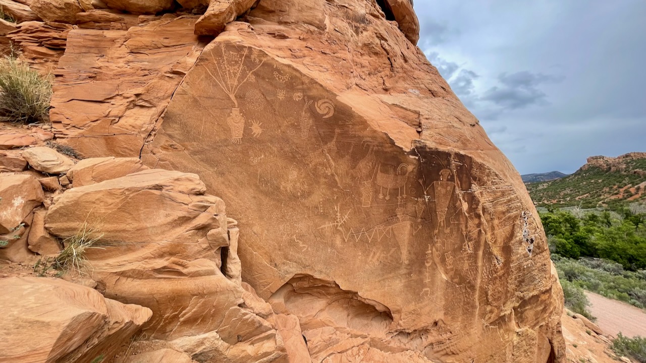
We didn’t need to know why they had done that, but Susan and Paul have dabbled with the arts, the why is easy, you do it because you want to do it. But how could they have the time to painstakingly make these? A plaque here tells us.
Life in the high deserts of Utah and Colorado is commonly viewed to be a bleak and difficult existence. This is due to the challenges encountered as pioneers and other groups ventured into the region. However, we know that indigenous peoples lived comfortably throughout the Colorado Plateau for thousands of years. How do we know they were comfortable? Cultures struggling to survive do not have time or resources for creating artwork, regardless of its purpose.
The creation of these images would have been time intensive and taken people away from other important daily tasks, like finding or growing food. Even so, it was not seen as a drain on resources but a worthy endeavor. The people living here cultivated crops that grew well in the landscape and hunted the large game herds that migrated through the area. They accepted the desert for what it was and found it to be bountiful when properly cared for. Because of their efforts to live with the land, and not simply upon it, they found success where many have not.
There’s a good lesson in there.
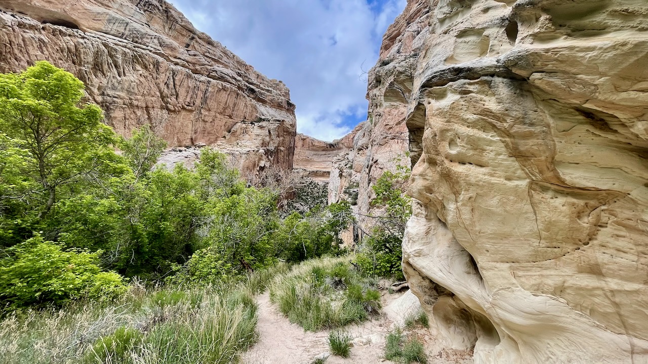
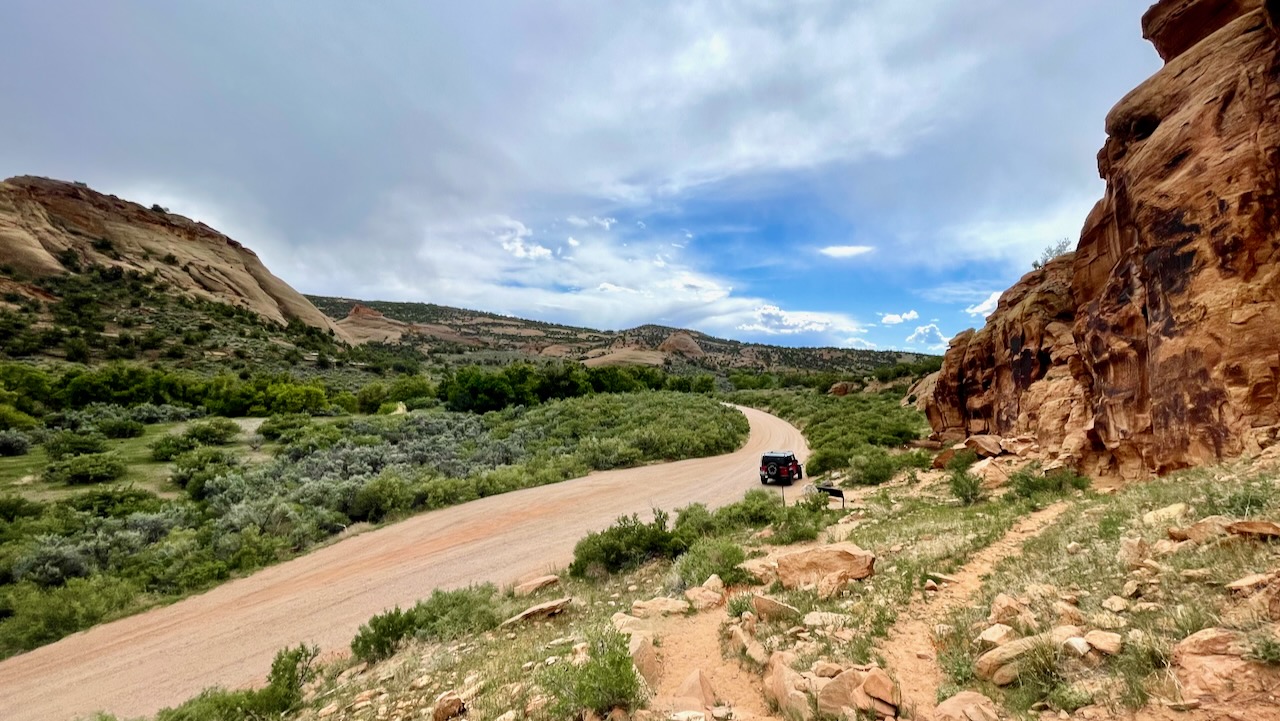
One more beauty shot to end the post.
We leave Dinosaurland tomorrow and continue heading home. A few days ago we realized that Memorial Day was sneaking up on us. We had hoped to be home by then. At this point it would mean rushing the trip. Alternately, we could be in the middle of nowhere and stay off the roads avoiding the Memorial Day traffic. We chose the latter and will be spending that time at the Yampa River State Park in Colorado. We couldn’t book one site for the 6 nights so we had book two different reservations, one for the first half, one for the second half. We’ll leave there May 28th.