Prescribed Burn
May 17, 2024 – Day 63
Vernal / Dinosaurland KOA Holiday, Vernal, UT
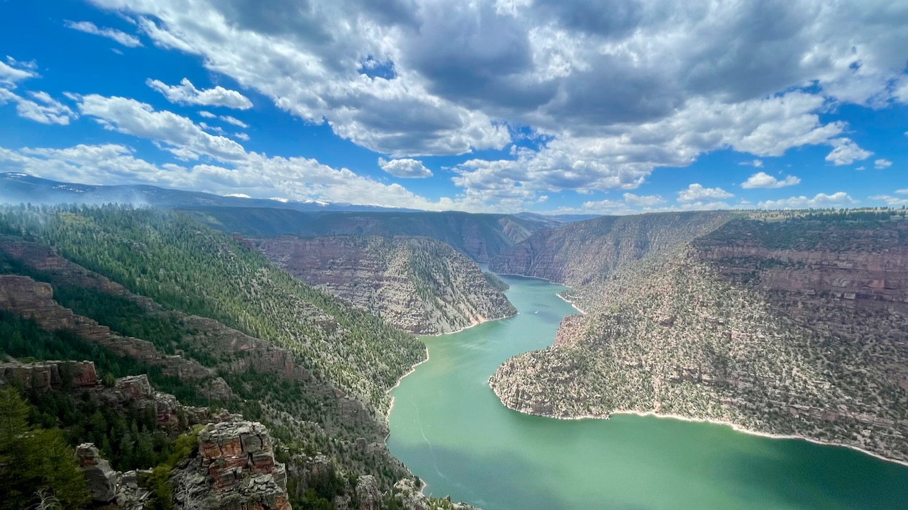
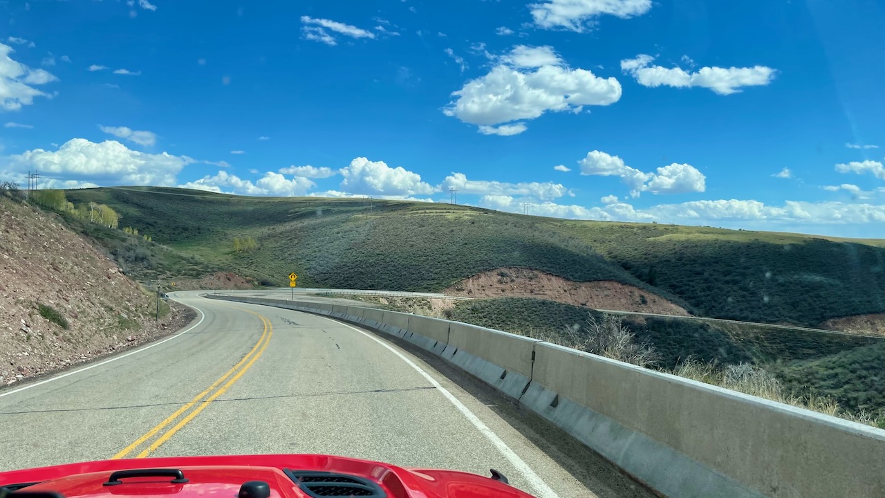
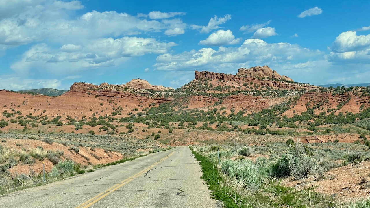
Today we headed north to see the Flaming Gorge area, which is in the very large Ashley National Forest. The drive there was incredibly scenic. We passed lots of different geologic strata. There were descriptive signs all along the highway that named the layers and told what sea creatures, and later land creatures, lived here hundreds of million of years ago. Here’s a photo from the return journey, heading back down.
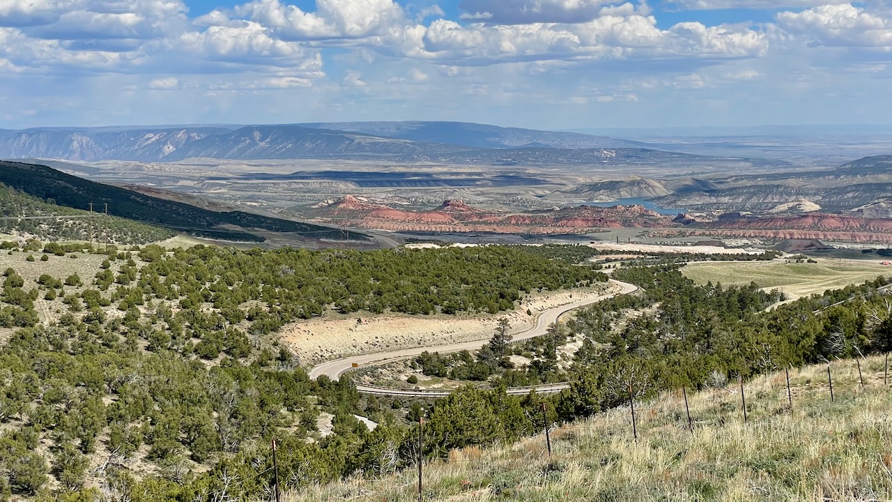
We’ll go into detail later, when we visit the museum downtown. We kind of wished we went there first. We would have better understand what we were seeing as we were driving by. We climbed from about 5,500 feet to 8,400 feet in about an hour. There were signs telling you how many switchbacks you had left!
But the road was beautiful. You can see a sign mentioning the layers and animals to the right.

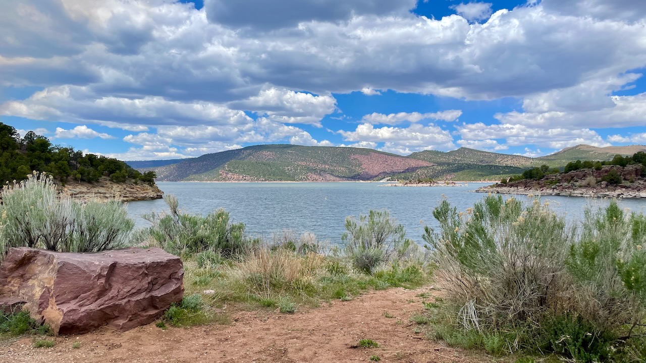
Towns are a long way from each other out here and it’s easier just to pack your own lunch and snacks. The views are often better, too! We picnicked, waterside, at the Flaming Gorge Dam. They had half a dozen picnic tables setup. It was empty so we were able to choose the one with the best view. We could see blue herons, Canada geese (susan here: we had just commented that it’s been ages since we’ve seen any.) and other small birds. It was a very pleasant area for lunch even if the day was a bit cloudy and cold.
After lunch, we saw the exhibits in the Visitors’ Center and drove across the dam.
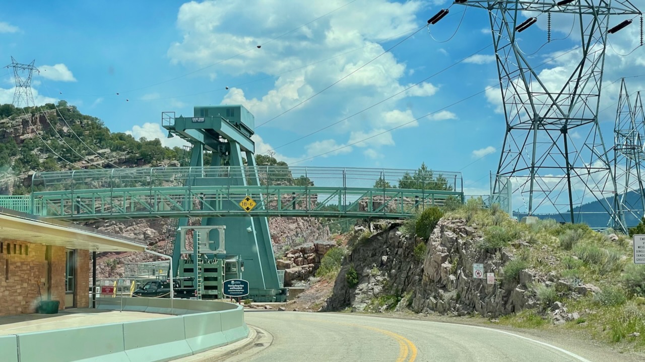
There was a nice pullout midway through the dam’s height were you could really see it.
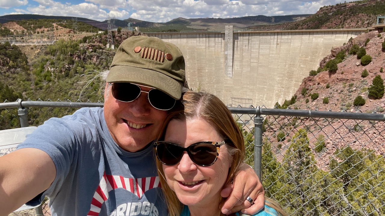
This impressive view of the dam reveals its mass and height. The dam stands 455 feet (140 meters) above the river channel. It extends below the river bottom for another 47 feet (14 meters), where it is anchored in bedrock. One million cubic yards (765,000 cubic meters) of concrete were used to build the dam and pavement
from a plaque
We continued down from the viewing area to the boat launch for a different view. That rock sure looks like it is going to fall!
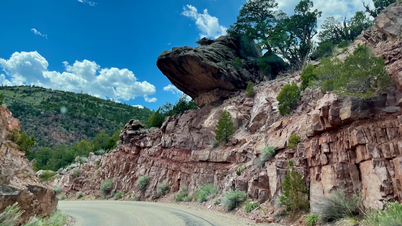
You probably don’t drive under it but it was pretty spooky nonetheless. We never made it to the bottom, there was a fee station and we didn’t feel the need to pay a fee just to look at the dam again.
We drove to the nearby Red Canyon, which was still in the Ashley National Forest. Along the way we passed by a sign for the Historic Swett Ranch.
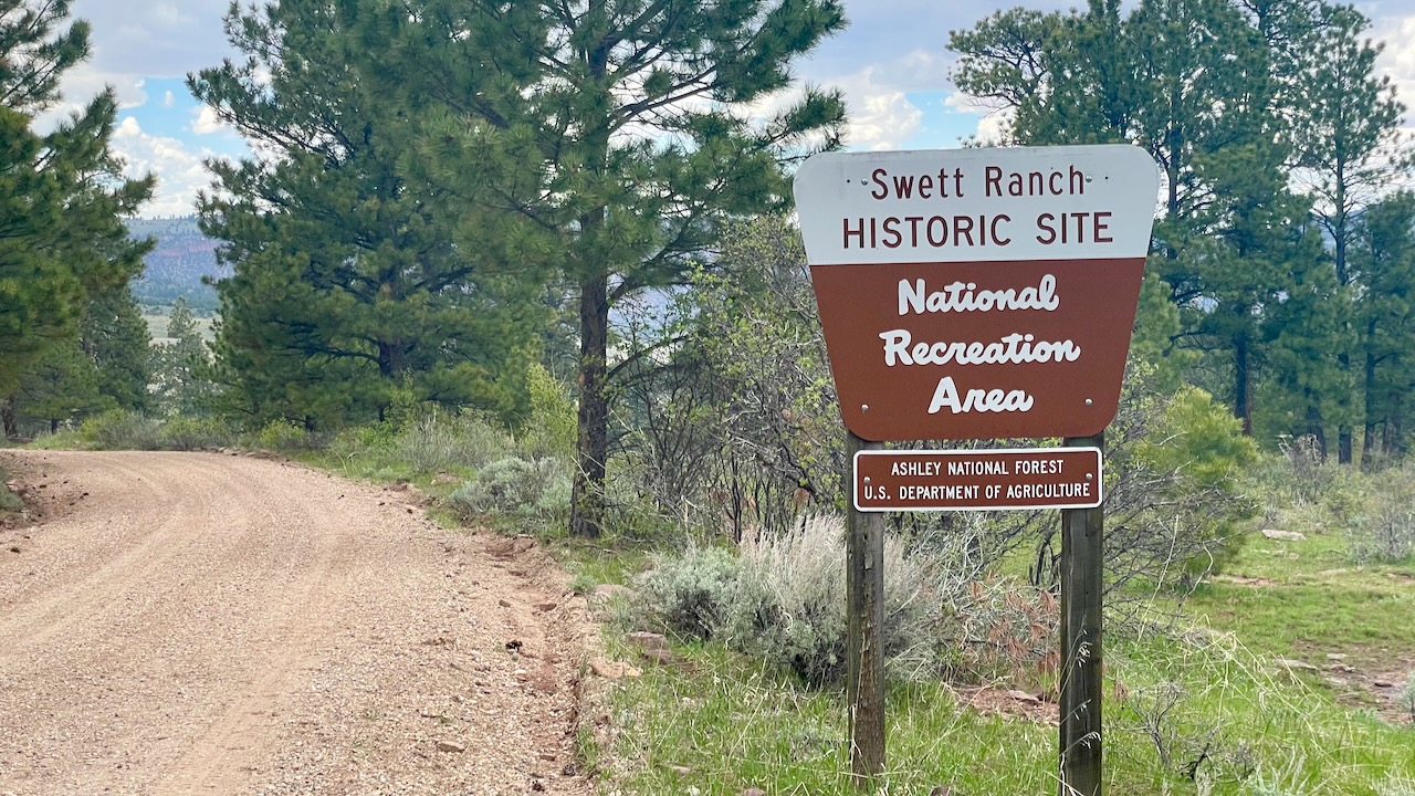
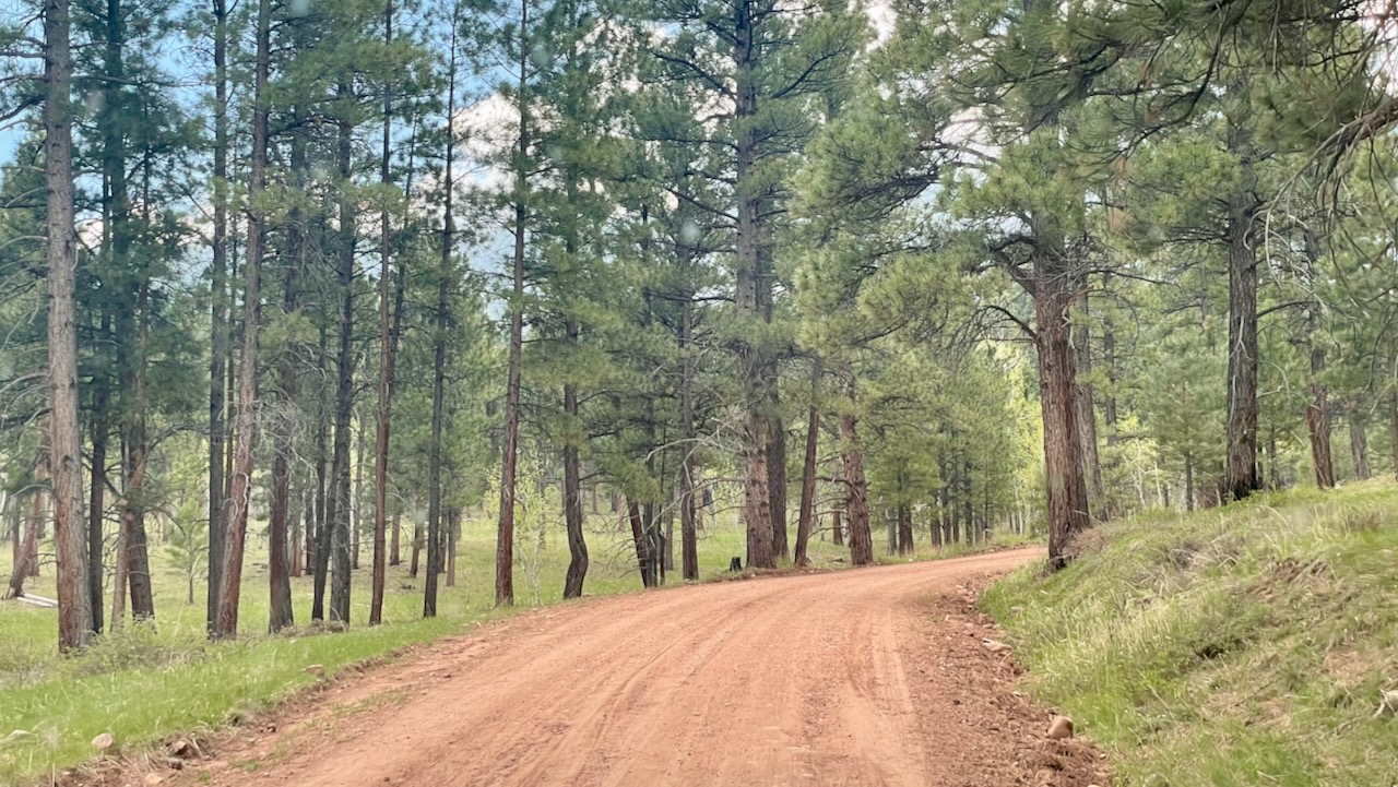
This is fun because our good friends are named Swett! Sadly, it opens on Memorial Day so we didn’t get to visit it. The road to it was beautiful dirt road.
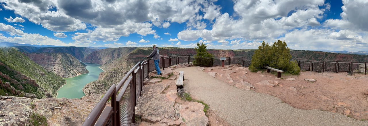
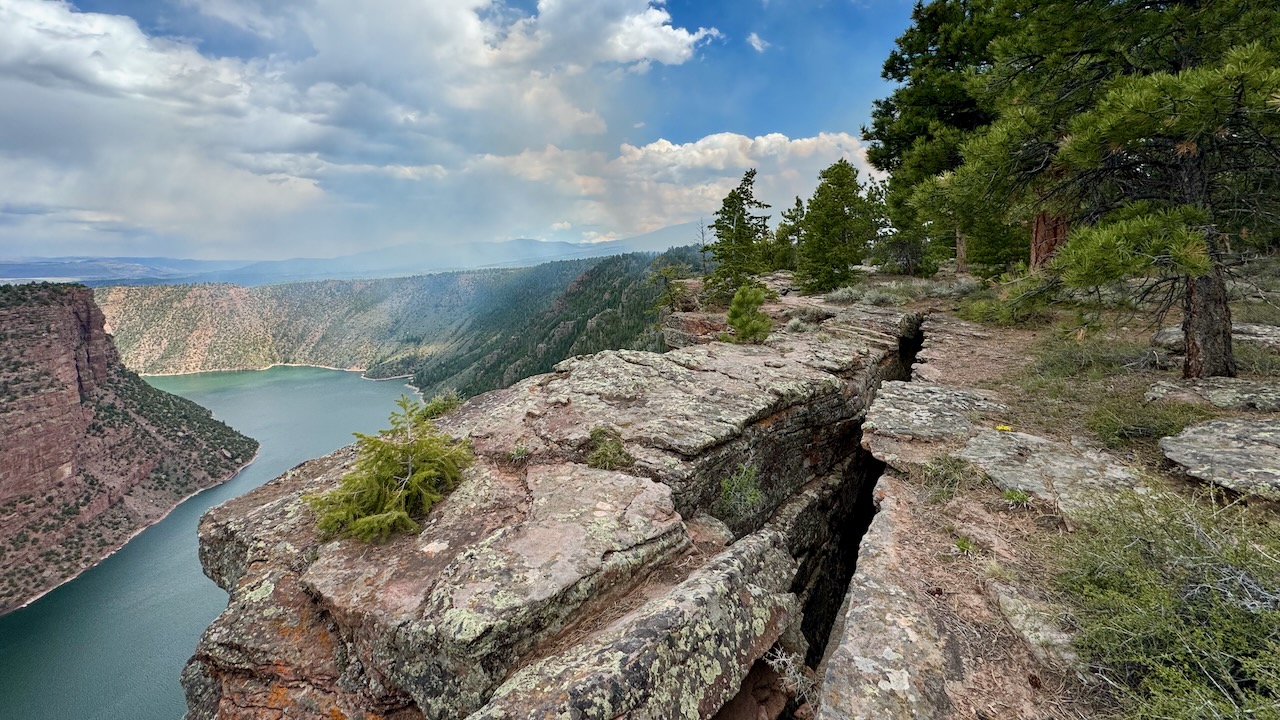
A scenic overlook gave us this view.
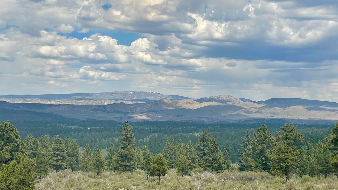
We spoke with some Jeepers there. They were from Indiana and, like us, appreciated the different landscapes. They had flown out and rented the Jeep. They left the lookout, going down a dirt road which led to the closed Swett Ranch. They were all smiles so we weren’t about to tell them the ranch was closed. It is sometimes just about the journey.
We had seen some smoke off in the distance. Now we were smelling it. Soon, we saw signs for “RX BURN DO NOT REPORT” and shortly we came upon the fire fighters.
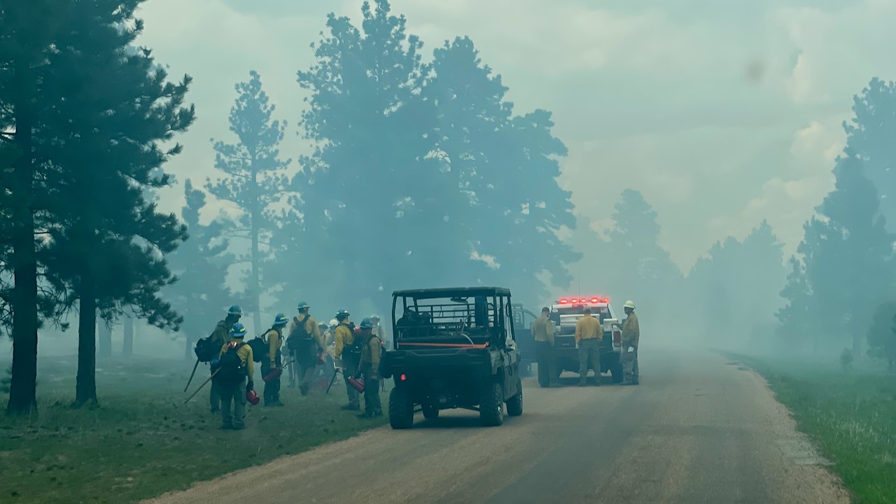
Curiously, not a single one was wearing any sort of mask or respirator. The smoke was thick and when we left we realized our throats were scratchy and we were only in it for a few minutes.
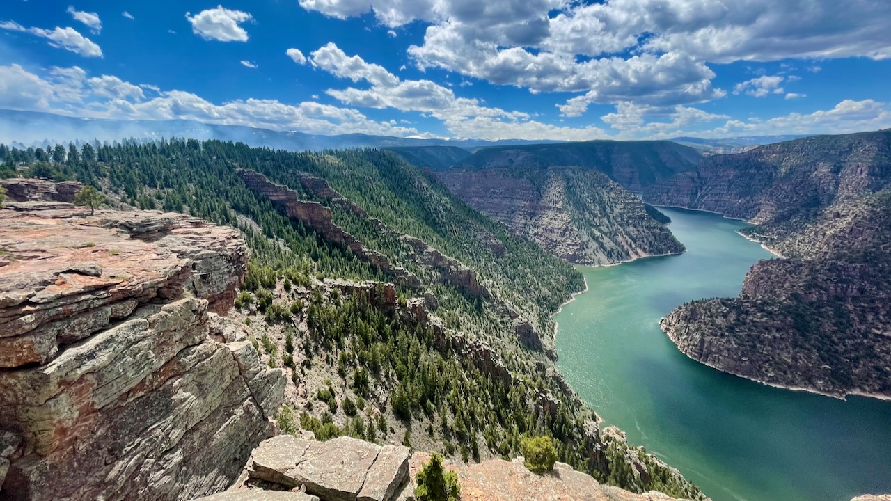
The Red Canyon did not disappoint.
RED CANYON
DEPTH. 1700FT – WIDTH ABOUT 4000 FT.
GENERAL WILLIAM H ASHLEY, POLITICIAN FUR TRADER AND EXPLORER DESCENDED-THE GREEN RIVER THROUGH RED CANYON MAY 3, 1825. SEEKING A ROUTE TO THE GULF OF MEXICO HE WAS FOLLOWED BY WILLIAM MANLEYCON HIS GOLD VENTURE TO CALIFORNIA) IN 1849, MAJOR JOHN WESLEY POWELL IN 1869 AND AGAIN IN 1871-72.
INDIANS, EXPLORERS, MOUNTAIN MEN, HUNTER,. TRAPPER, OUTLAWS, STOCKMEN AND RANCHERS HAVE GIVEN THE CANYONS AND VALLEYS A COLORFUL HISTORY THIS AREA BECAME PART OF THE NATIONAL FOREST SYSTEM BY AN EXECUTIVE ORDER SIGNED BY PRESIDENT THEODORE ROOSEVELT JULY 1, 1908.
From a sign in the overlook
You could see smoke from the fire filling the canyon.
Now, we’ve talked about the smoke and shown it to you. What we’ve not mentioned is that there was a campground right there, mostly tents and vans, not that it matters, the campground was also full of smoke. That must have been exceptionally unpleasant. (susan here: no way I could be comfortable with all that fire and smoke around. I’d be too nervous about it getting away from the firefighters. Also it was exceptionally unpleasant to breathe and even an hour later you could still feel it in your throat and nostrils.)
It was a little disconcerting standing on the other side of this crack.
One more picture…
See those cool knife like vertical ridges? We have no idea what made them. We were disappointed that we missed The Red Canyon Visitors’ Center. It opened the next day!
Oh the way out we passed through the burn area again. Paul got the “money shot.”
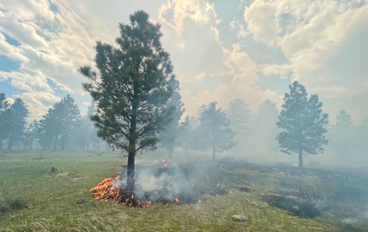
Susan was driving and Paul rolled down the window and took this from the Jeep. He reported that he could really feel the heat on his face.
It was time to head back to Vernal which meant we went down all the switchbacks that we had just come up.
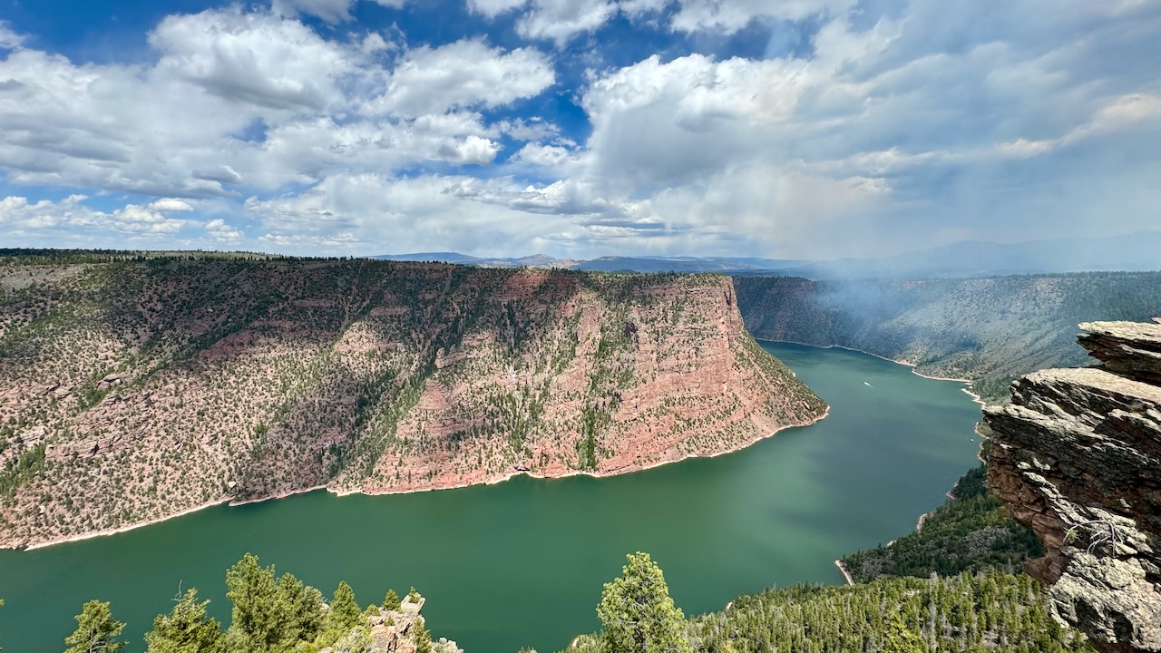
Let’s show the first picture again.
Why? The overlook gives us a geology lesson.
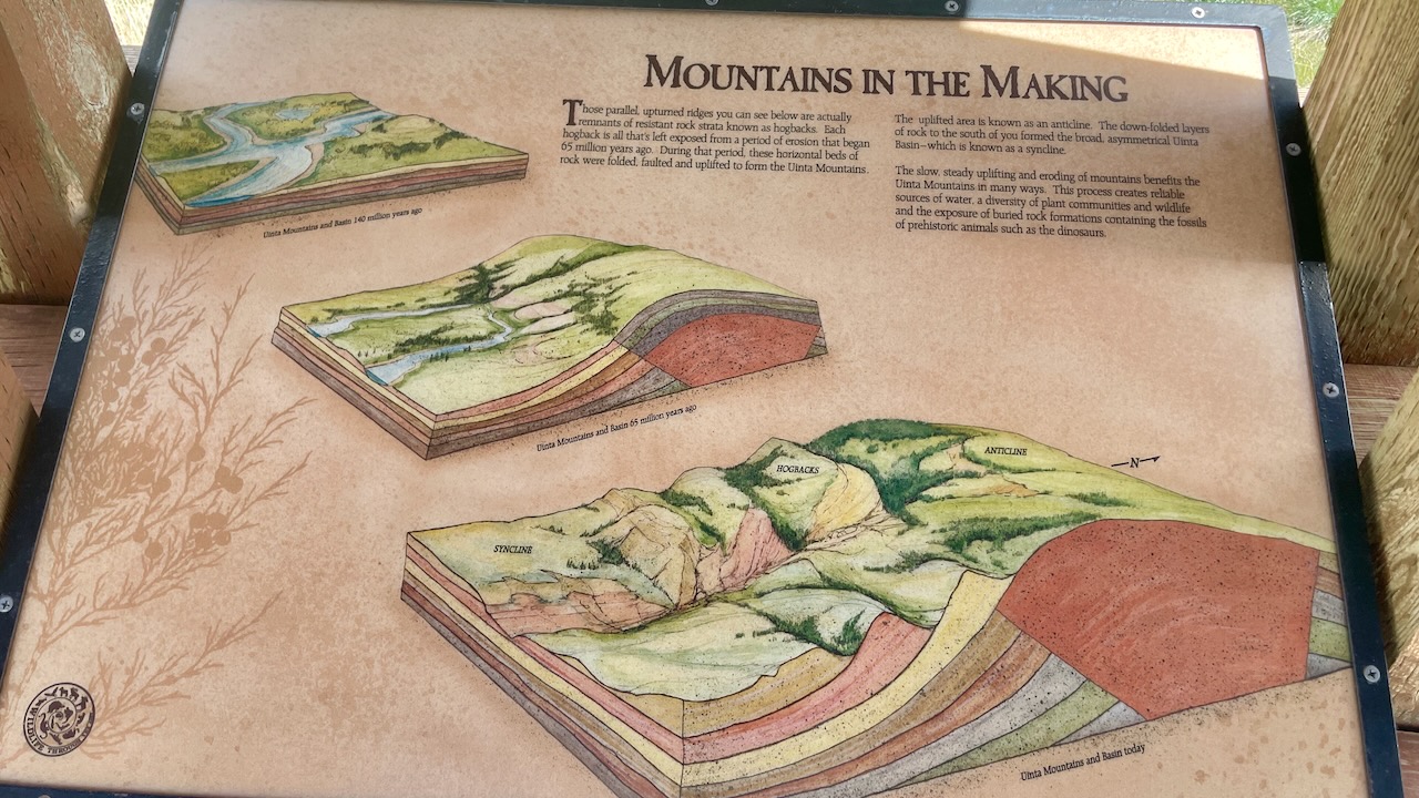
Those parallel, upturned ridges you can see below are actually remnants of resistant rock strata known as hogbacks. Each hogback is all that’s left exposed from a period of erosion that began 65 million years ago. During that period, these horizontal beds of rock were folded, faulted and uplifted to form the Uinta Mountain.
The uplifted area is known as an anticline. The down-folded layers of rock to the south of you formed the broad, asymmetrical Uinta Basin-which is known as a syncline.
The slow, steady uplifting and eroding of mountains benefits the Uinta Mountains in many ways. This process creates reliable sources of water, a diversity of plant communities and wildlife and the exposure of buried rock formations containing the fossils of prehistoric animals such as the dinosaurs.
There was a side road to see some dinosaur tracks, so of course we had to go check it out..
We never made it to the tracks. We found the parking area just fine. The hike was listed as “rugged” and 1.6 miles round trip. Neither of us were prepared for that. Water, hats, hiking boots and long sleeves are pretty much mandatory. Maybe we’ll be back someday.
(susan here: If the 6000′ elevation doesn’t get you the sun will will cook you and finish you off. Sun is stronger at lower latitudes because it’s more direct and it’s 4% stronger for every 1000′ increase in elevation. The two together can make a 70F day feel pretty hot.)
Life Birds: 2 (Clark’s Nutcracker, Mountain Bluebird)