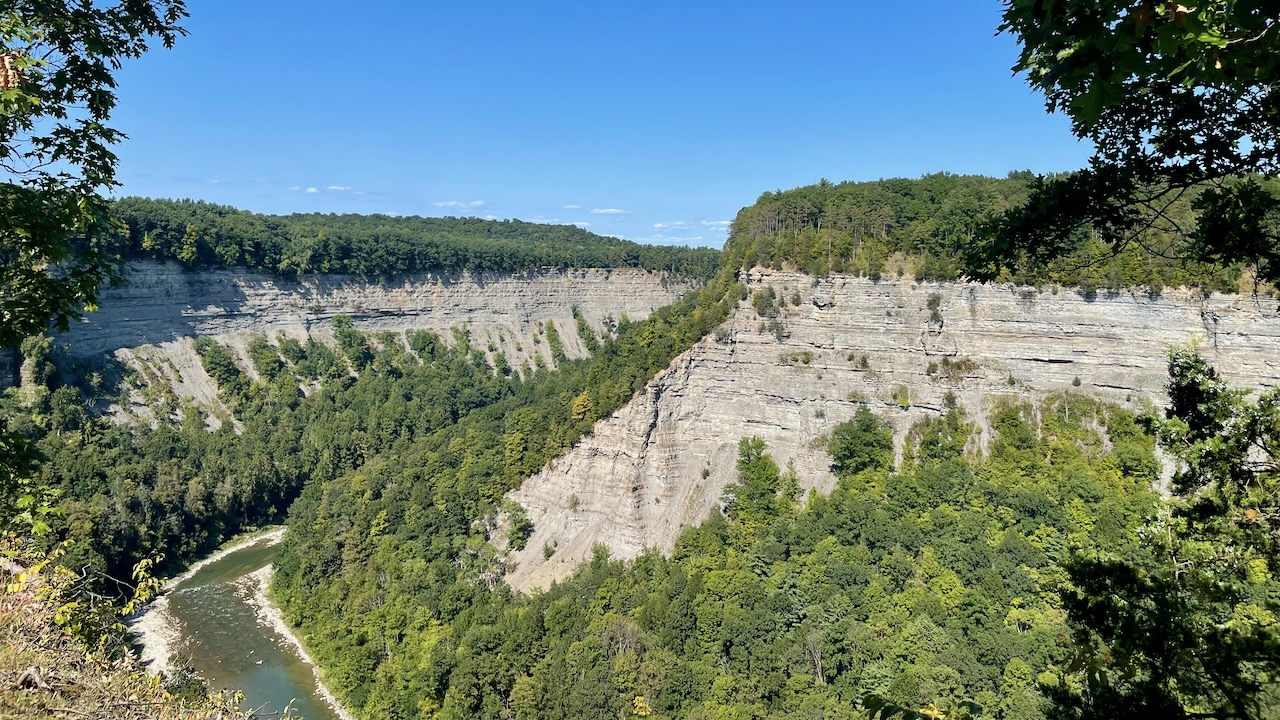
The “cough” Grand Canyon of the East “cough”
September 3, 2024
Letchworth State Park
Ok, about the title. We didn’t decide to call Letchworth State Park the “Grand Canyon of the East,” NY State decided that. And the park isn’t bad. Actually? It’s pretty awesome! But Grand Canyon of the East? That’s a pretty lofty claim. mmm…we think some market-droid had a little too much latte in the afternoon. (susan here: a tipple laden latte.)
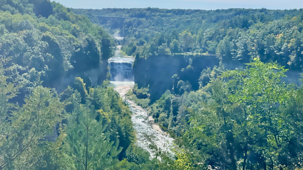
Ok, it is pretty impressive. The Genesee River comes through here, dropping three pretty impressive waterfalls in a short distance. There are 66 miles of hiking trails, not that we hike much, however 2 of the 3 waterfalls are easily accessible from the parking lots!
The park is huge, we left the campground mid-morning, started driving down to the falls, about a 20-30 minute drive, hoping to find the restaurant the park’s map promised. It was pathetic. Microwaved hamburgers and other crap food at highway robbery prices. No thanks. We left the park and went to a small town diner, Parkside Diner in Castile, NY. Both lunches were pretty good!
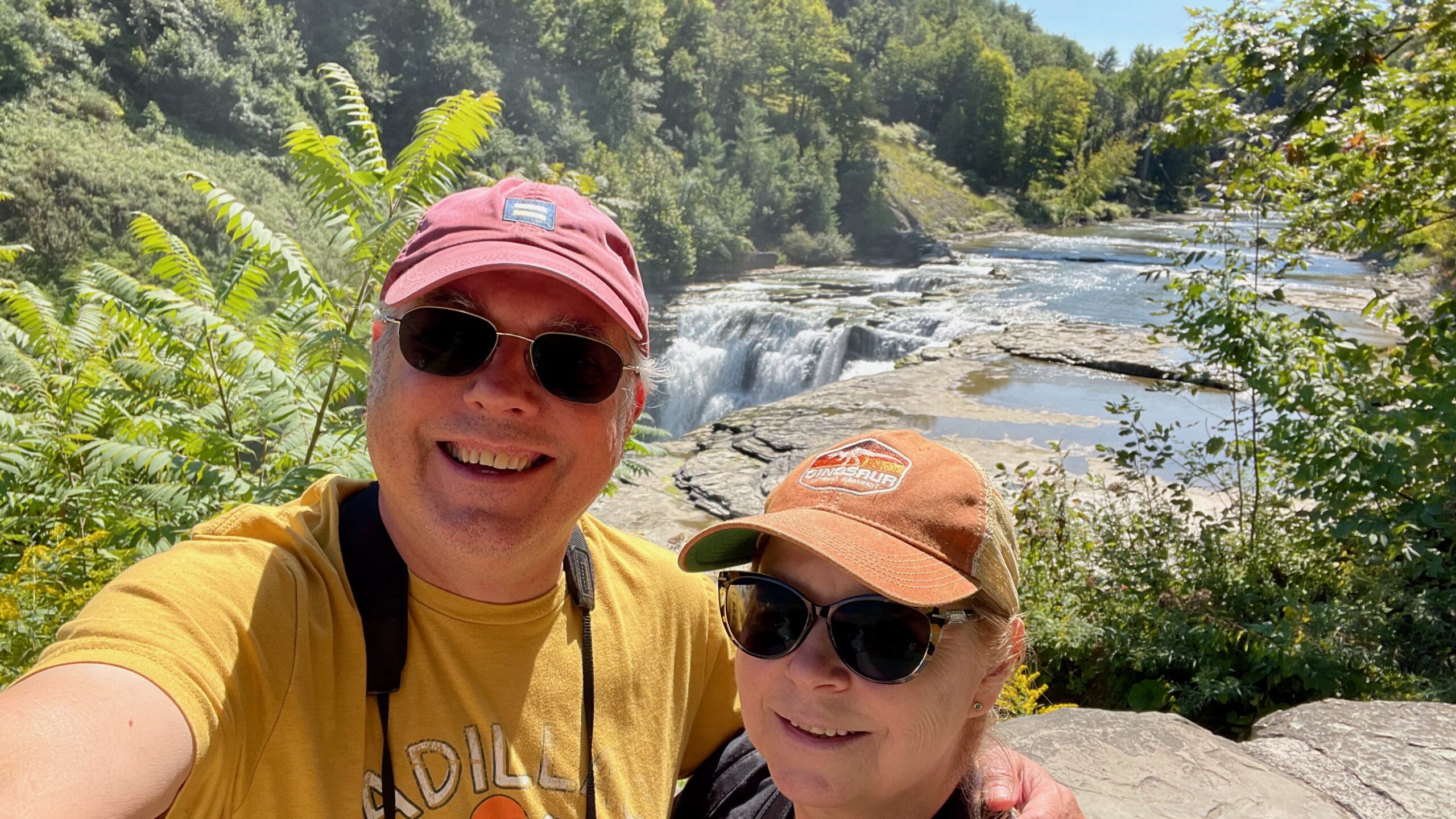
When we go back into the park, Paul made sure to ask about the stair-steps to the park. Upper and Middle were easy, Lower had 170 steps. Ok, we can do that. We entered the park, found a sign for Upper and parked, and then we saw the steps. It was easily 100 or 150 steps downwards. (susan here: I remember what the park ranger said, it was 127 stairs. They were flat-ish stones cemented together to make stairs. None of them had a proper run or rise so they tended to be quite awkward to walk on.) Ok, so maybe we’re at the Lower Falls, not the Upper like the map was screaming at us about. The falls were pretty impressive.
Let’s back up and see the bridge!
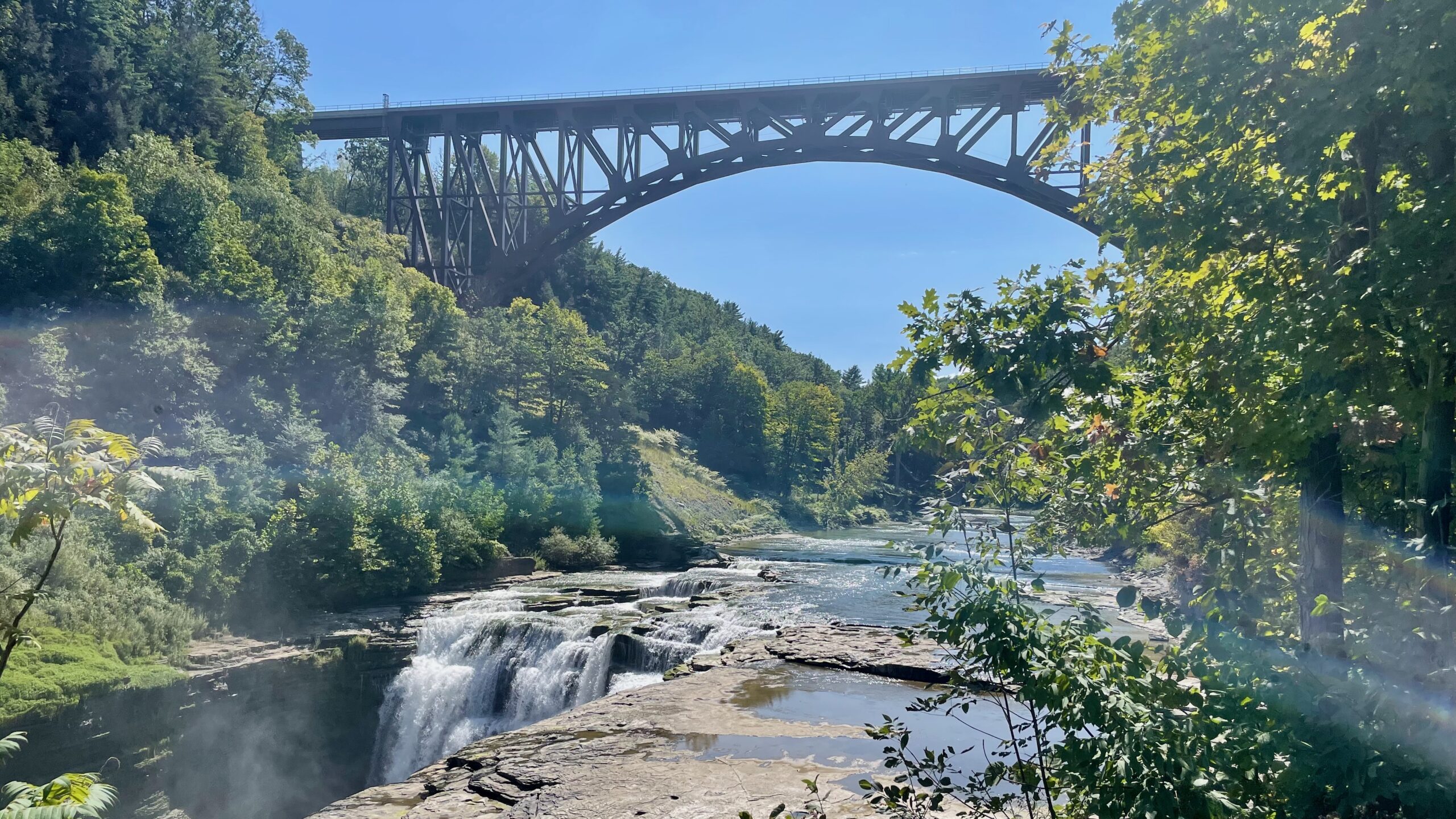
The Genesee Arch Bridge or Portageville Arch Railway Bridge is a spandrel-braced, steel arch bridge stretching 483-feet and rising over 200 feet above the Genesee River. The weight on an arch bridge is pushed out along the curve of the arch to its end. The spandrels extend from the deck to the arch providing support for the deck while the diagonal bracing provides additional support for the bridge deck. The iron bridge in the background was subsequently removed once the arch bridge was completed and put into service.
That’s a little confusing since we didn’t copy the entire sign. There used to be a wooden trestle bridge here. That caught on fire because coal cinders and wooden bridges are a bad combination. Then they built the iron bridge which lasted for quite some time. You’ll have to google it both because we’re lazy and we’re really behind in blogging. That was recently replaced by the current bridge, seen above. (susan here: since Paul is too lazy to google it for you, let me do it for you: The Portageville Bridge Replacement) But you can still see the no-longer-there iron bridge on fridge magnets in the gift shop. Phew…
After trudging back up the uneven stairs we continued down Park Drive to the Upper/Middle Falls parking lot. Upper? Didn’t we just leave that?
Hmm, we make the easy walk from the parking lot back to the Upper Falls, now we can see them from the bottom, without any stairs!
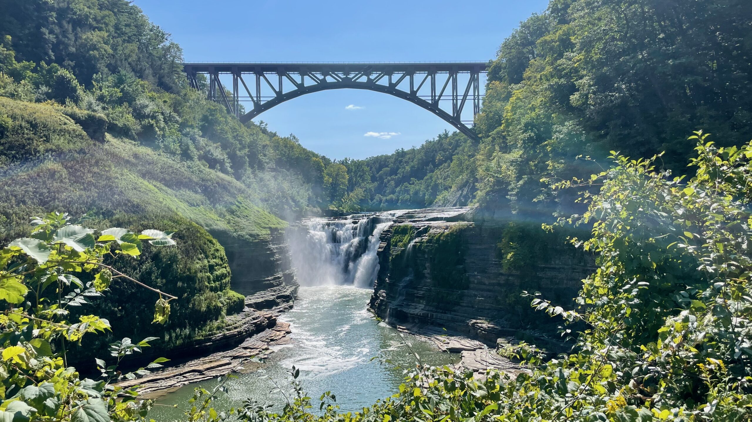
Oh, look, a bridge!
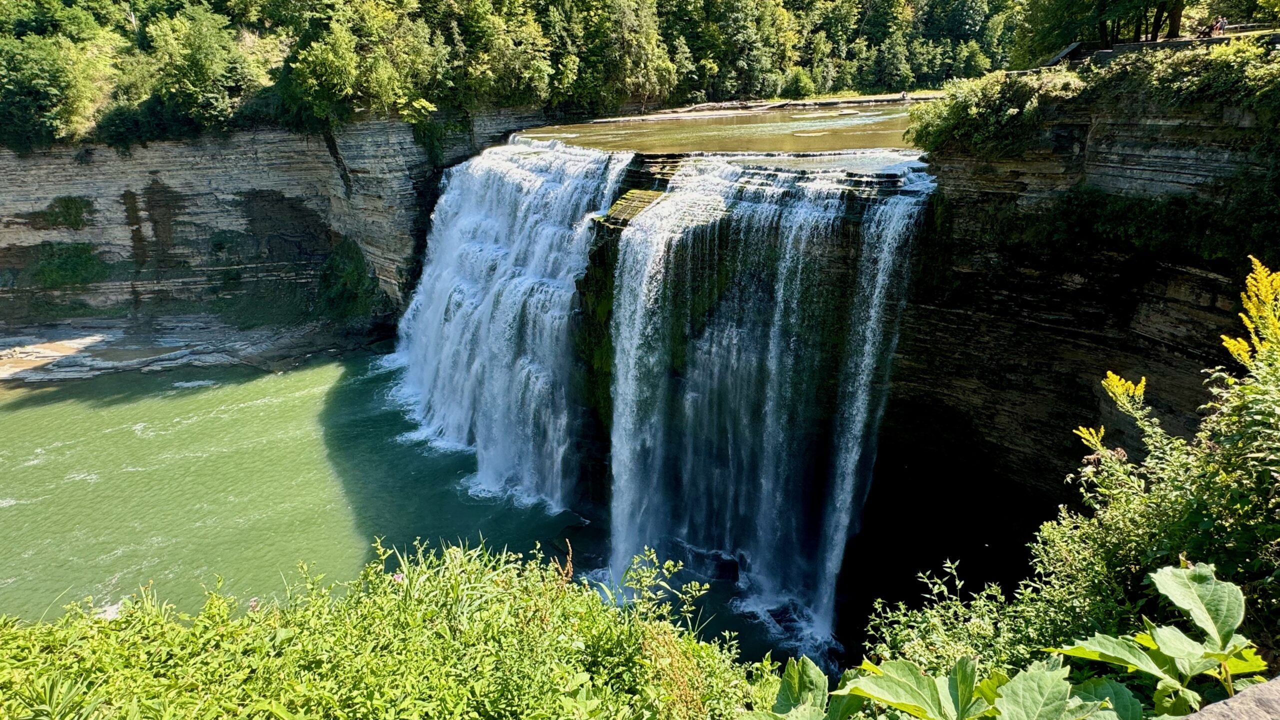
Now onto the top of the Middle Falls.
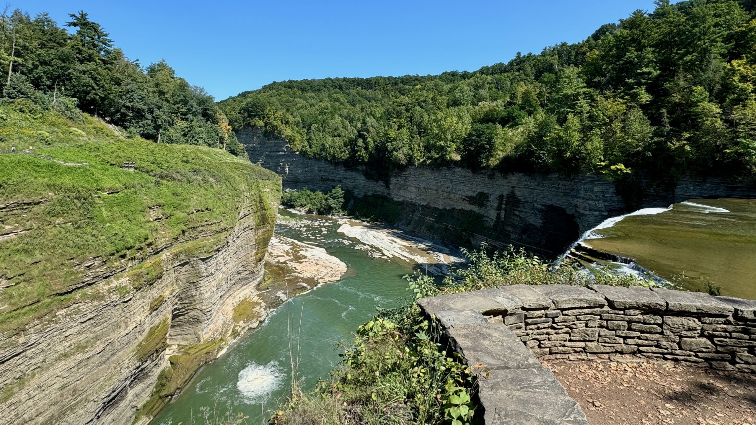
And then off to the side:
Susan noticed big lights across from the falls and asked a nearby ranger about them. Why yes! They do light them up at night to illuminate the falls. Just the Middle, not the Upper or Lower.
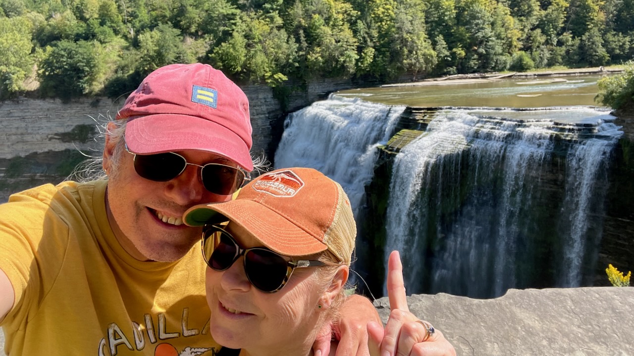
We decided to not try for Lower Falls today, just meander back to the campground and stop at the dozens of overlooks, some were great, some were only okay. Hey NY State, it’s hard to see the overlook if you have trees blocking the view! So how about you trim the greenery at the posted overlooks, ok?